Heat advisory likely to persist through July 4th in North Texas, followed by rain chances

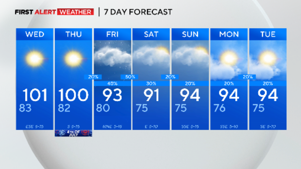
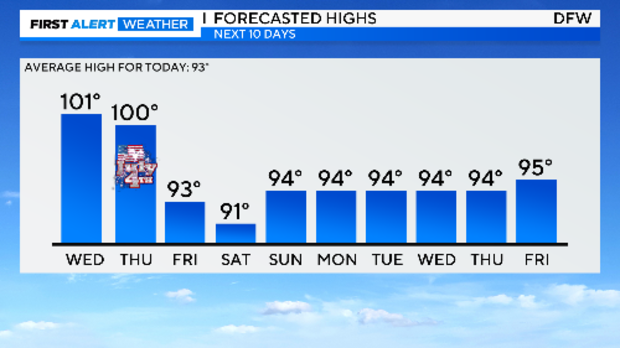
NORTH TEXAS – Another July day, another 100° day. It marked our second in a row and the fourth time this early season.
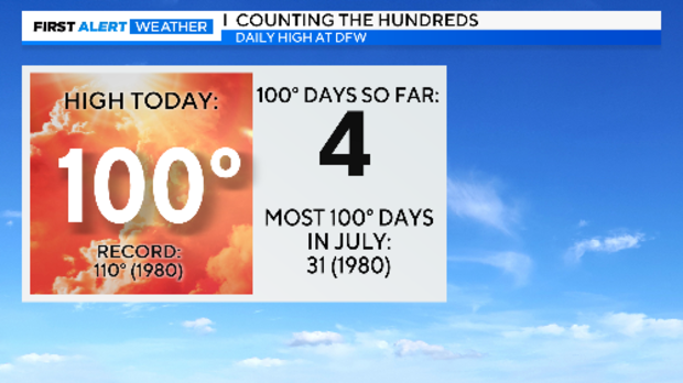
So, every day in July so far, it's been 100°. Back in 1980 every one of them hit at least 100°. Our current streak of two continues for two more days, then rain chances show up on Friday to cool us down.
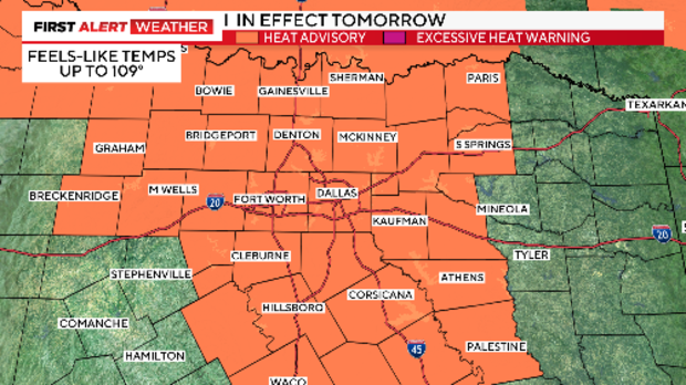
We believe the heat advisory will continue into July 4th. Make sure your heat precautions follow with you.
The heat dome that has dominated our weather pattern over the last week ebbs away to the east starting late Thursday. This opens the door for a rare July cold front. It arrives Friday and stalls over us on Saturday.
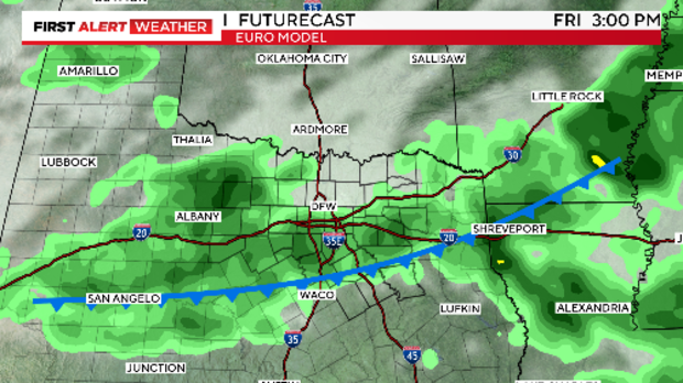
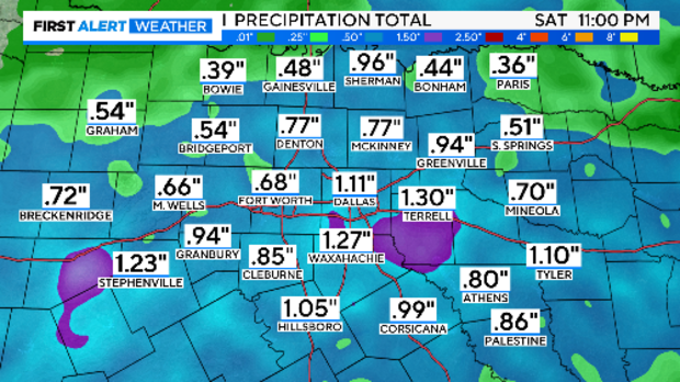
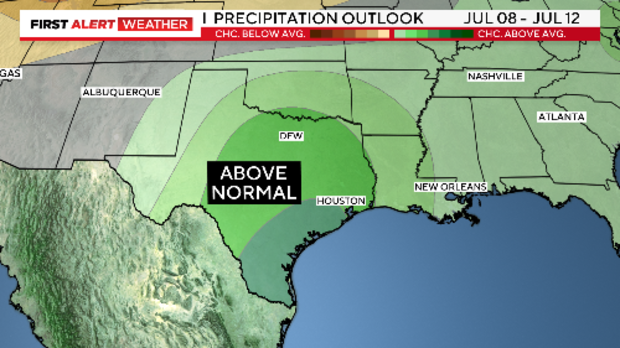
The rain chances seem just as good on Saturday as they do on Friday. We are not expecting severe weather. DFW hasn't seen measurable rain in three weeks. Some areas could get one inch or more over the two-day period.
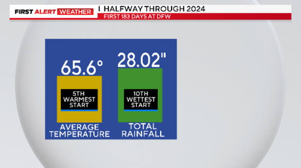
As of Monday, we are halfway through the year. So far it is a record year with both the temperature and rainfall in the Top 10 (the records go back to 1899). We are expecting cooler temperatures starting Friday but are expecting more rain.
Hurricane Beryl plays into this. Right now, the extremely dangerous hurricane is forecast to directly hit Jamaica tomorrow as a major storm (a strong Category 3). On July 4th, it hits the Cayman Islands as a Category 2 hurricane. On Friday it comes onshore on the Yucatan and weakens. What happens to Beryl once it gets into the Gulf of Mexico? Models don't give much guidance.
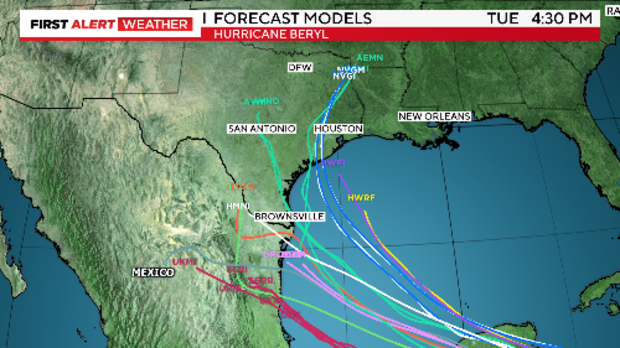
Interesting to note that the upper air pattern is lending a hand on getting some of the tropical rain from Beryl into Texas. At the end of the weekend, we'll find ourselves in between two high pressure systems. This area is called a "COL" and it is a very weak low-pressure area than serve as a magnet and draw up the moisture to our south.

While it is nearly considered meteorological malpractice to show this, at least ONE forecast model (the GFS) shows this exact scenario Tuesday.
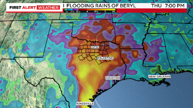
And the CPC also is on board with the general idea. Next week is expected to both cooler and wet.
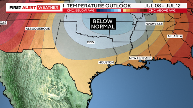
The 10-day outlook has zero 100° days in the forecast after July 4th. Wow.
Let's hope we can tap into at least some of the Beryl rain. July and August are the two driest months of the year. Rain is always welcomed this time of year. Right now, I'll keep a modest 20% chance early next week. Look for updates.