Heat Advisory issued for Monday, more likely to come
NORTH TEXAS (CBSNewsTexas.com) - A Heat Advisory is issued for Monday with feels-like temperatures close to 110° by the afternoon in some spots.
Several rounds of rain kept the heat at bay Sunday and North Texas could stay below 90° for the day.
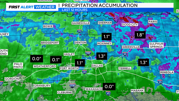
We saw precious July rain Sunday morning, quite generous in some areas with a bit of wind damage reported in Fannin County.
In our northeast counties Sunday morning there were a couple Thunderstorm Warnings and a flood advisory. Radar estimates of 1" plus rainfall from northern Dallas County and north, northeast.
About a third of an inch of rain fell at DFW (0.32"). Sad to say this was the biggest rain day this month and the most since mid-June.
During the morning hours when there was rain in the area, the DFW Airport registered a staggeringly high dewpoint of 78° for a few hours. This ties an unofficial record for highest dewpoint recorded for this date. Once the sun came out this afternoon the dewpoint dropped.
There's not much in rain chances until next weekend.
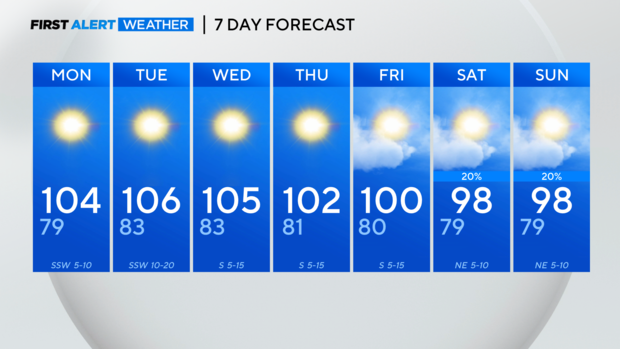
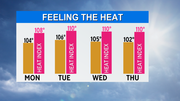
By Monday afternoon we are expecting a heat index to approach 110° in some spots across the metroplex. Tuesday could be the hottest day of the year so far.
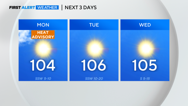
A Heat Advisory is in place until 9 p.m. Monday and it is likely it'll be extended deeper into our work week.

With lots of sun and lots of heat this week, please continue to be cautious if working/playing outside.
Here is the First Alert 7-Day Forecast. Some rain chances show up next weekend, enough to knock the temperatures down just a tad.