Heat advisory in place for North Texas
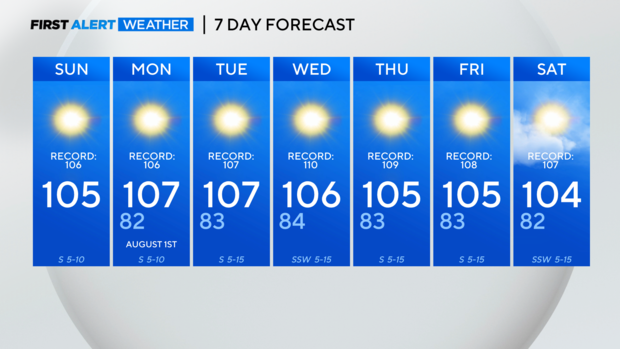
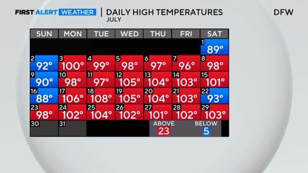
NORTH TEXAS (CBSNewsTexas.com) - We hit 103 degrees yesterday for our 21st 100+ day, surpassing the yearly average of 20 days. July will finish out with more triple digits and the count continues to go up through the first week of August.
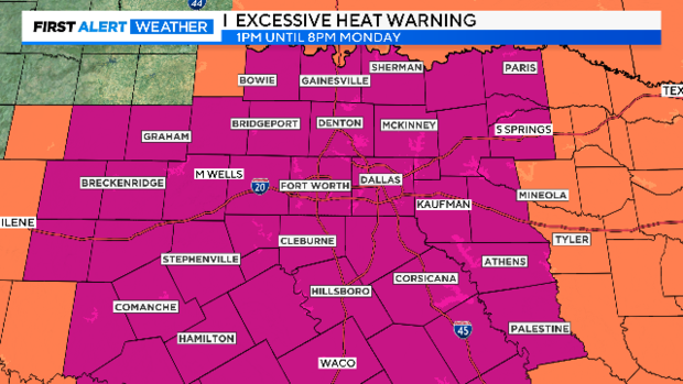
Sunday afternoon will bring highs near 104 degrees. A heat advisory goes into effect at 1:00 p.m. Sunday. We are under an excessive heat warning Monday.
It will feel like 103-109 degrees at times so please continue those heat safety precautions. The advisory will likely be extended into Tuesday.
The heat is one reason to stay inside this afternoon, but it is also another Ozone Action Day. It will be unhealthy for sensitive groups including the elderly and those with upper respiratory issues.
Temperatures will reach the upper 90s by noon Sunday and top out at 105 degrees. Near record afternoon temperatures start today and extend into midweek. The ridge of high pressure to our west responsible for the sunshine and heat, tracks eastward and is right overhead to start the week.
A slim chance for rain won't arrive until potentially late next weekend. And, keep in mind, there is still a lot of time for these rain chances to vanish.
The continued dry stretch means the elevated fire danger also continues, especially along and west of I-35. The fire threat will shift a little east early next week as all of North Texas continues to dry out.