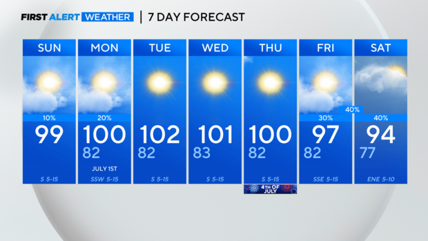
Heat Advisory likely to extend in North Texas ahead of late-week rain chances
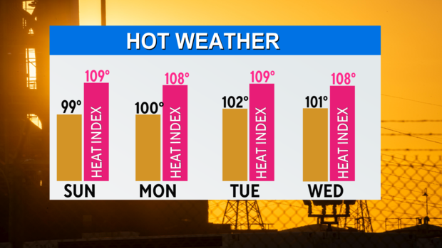
NORTH TEXAS — The heat and sunshine continue into the middle of the week, keeping feels-like temperatures each afternoon around 105-109.
North Texas will likely see the Heat Advisory extended into next week.
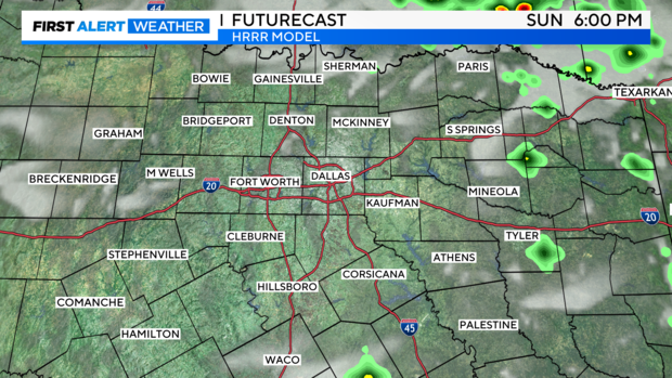
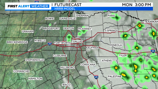
A few areas may see some raindrops Sunday or Monday with the best chance to the northeast and into east Texas.
Outflow from a front in Oklahoma may spark a few showers Sunday afternoon and as the front sags south Monday it could also generate some afternoon showers.
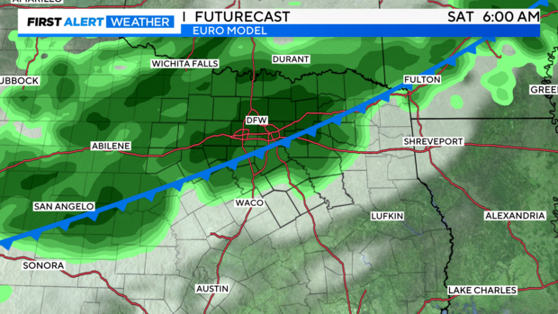
Better rain chances arrive late week, Friday evening into Saturday when a cold front moves into North Texas.
The clouds and rain will also knock a few degrees off our temperatures, with Saturday's highs in the mid-90s.
The first hurricane of the season, Beryl, is now a category 3 hurricane with a well-defined eye.
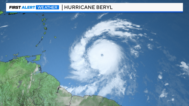
It is expected to continue to rapidly intensify as it nears the Windward Islands early Monday morning as a dangerous category 4 hurricane.
They are looking at the potential of a storm surge of 6-9 feet and 3"-6" of rain, along with winds of 130 mph.
The storm will encounter wind shear as it heads west in the Caribbean and may weaken a bit.
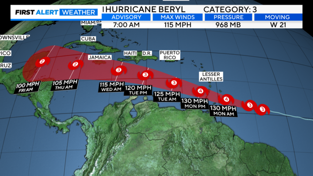
We will continue to monitor Beryl's projected track as it enters the Gulf of Mexico late this week.
In the meantime, enjoy the sunshine but remember your heat safety precautions.