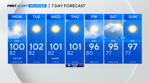
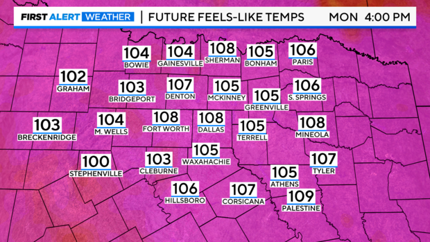
Heat Advisory and triple-digits continue for North Texas followed by chance of late-week showers
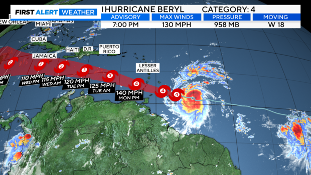
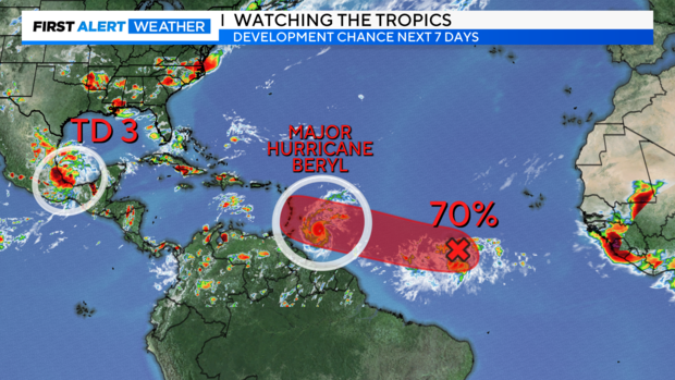
NORTH TEXAS — The Atlantic continues to roll with activity, including major Hurricane Beryl, which could potentially enter the Gulf late week.
Beryl is the first major hurricane of the Atlantic season, reaching category 4 status Sunday while undergoing rapid intensification. It is also the earliest Atlantic category 4 in recorded history - June 30. Sea surface temperatures and low wind shear aided in this rapid intensification, which is usually more of a late-season phenomenon, typically near the peak.
Another Tropical Depression (Three) just formed in the southern Gulf Sunday evening near the Campeche Sound. This will roll directly west into Mexico, similar to TS Alberto, bringing much-needed rainfall to the region and should weaken fast upon landfall. Farther out in the Atlantic, there's a 70% formation in the main development region, which could follow Beryl into the Caribbean.
A heat advisory is issued through 7 p.m. Monday.

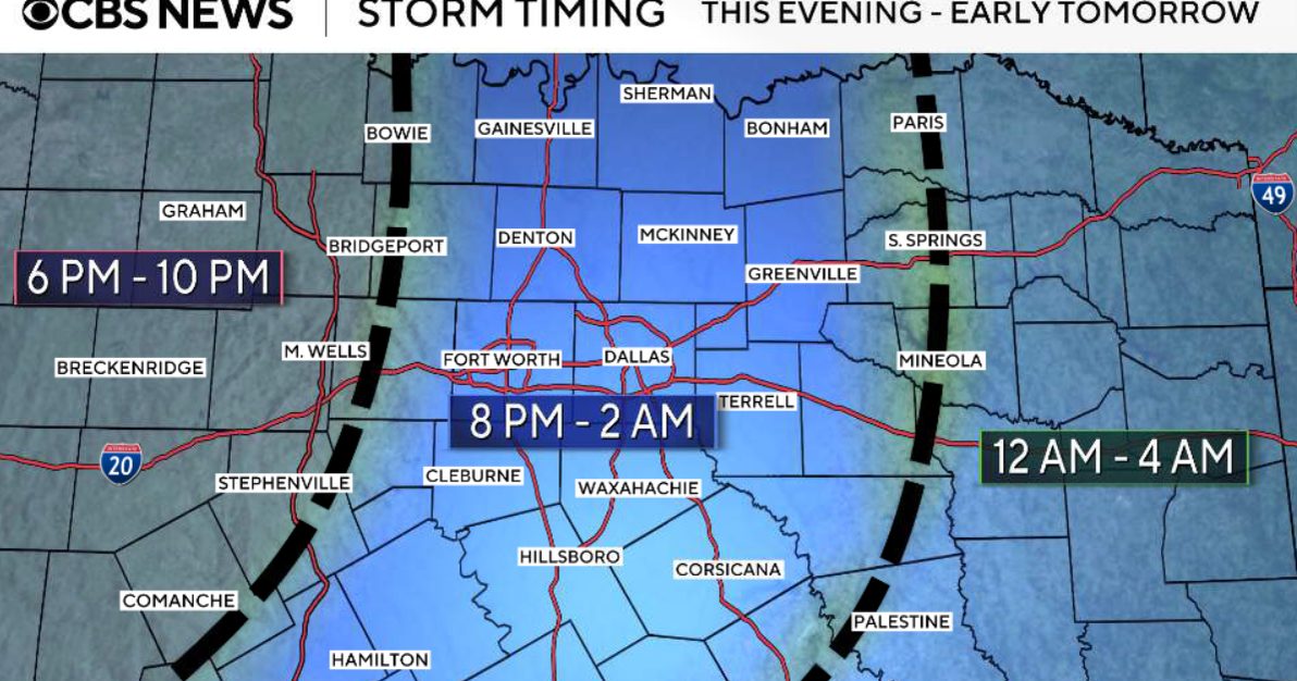
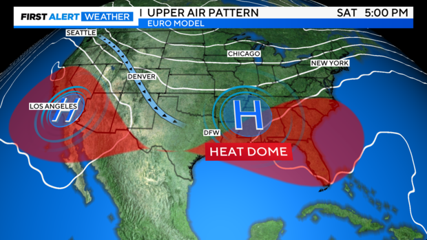
We've all been waiting for a change in the pattern: The high-pressure heat dome over North Texas from mid to upper levels should retreat and allow activity from the plains to move in Friday into Friday night and Saturday morning. Showers and thunderstorms appear very possible.
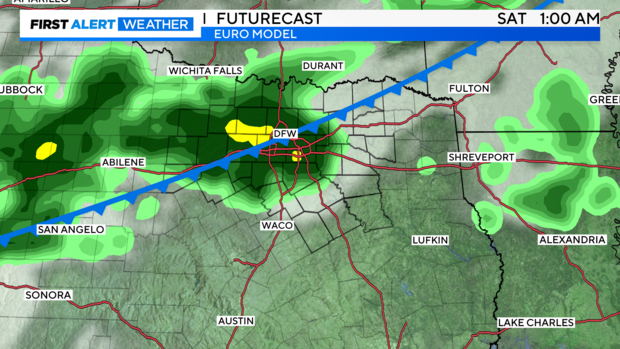
The latest run of the European model shows some of the heaviest rain overnight Friday into Saturday.
The 7-day forecast includes mid-90s and 40-50% rain chances.