Another gusty, dry day ahead for North Texas; Fire threat conditions persist

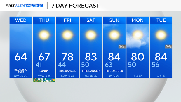
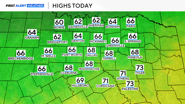
Wednesday will be another gusty and dry day with cooler temperatures ahead of a warmer weekend. The elevated fire danger continues through the end of the week into the weekend.
Patchy dust is possible on Wednesday as there is another windy and dry day ahead. A dry front moved through North Texas Wednesday morning, increasing the potential for fires but also bringing in the patchy dust.
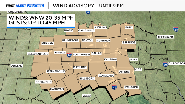
A wind advisory is in place today until 9 p.m. for another day with winds gusting to near 45 mph.
An area of low pressure in the mid to upper levels will continue moving northeast Wednesday and into the night. However, there will be a tight pressure gradient in place between that area of low-pressure exiting and an area of high pressure building into the Southern Plains.
The dryline continued shifting east through North Texas Wednesday morning, dropping dew points and then a dry front moves through North Texas and drops temperatures below seasonal averages for the next two days.
The fire threat is elevated Wednesday across North Texas and there are elevated fire threat conditions continuing through the end of the week.