Grand Prairie Fire: Weather Satellite Shows Smoke Moving South Across Tarrant, Johnson, Hood and Somervell Counties In Texas
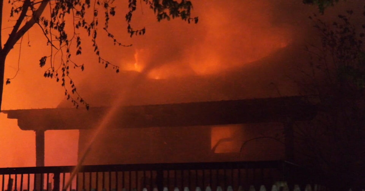
GRAND PRAIRIE (CBSDFW.COM) – Massive flames and smoke continued pouring from an industrial fire in Grand Prairie so much so that the dark smoke could be seen on weather satellite images Wednesday morning.
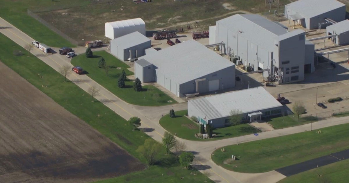
The fire was burning out of control Wednesday morning at the Poly-America manufacturing plant in the 2000 block of West Marshall Drive, west of the Highway 161/George Bush Turnpike near the Lockheed Martin plant.
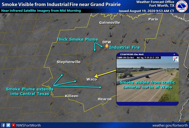
The above image released by the National Oceanic and Atmospheric Administration shows the path of the smoke.
CBS 11 Meteorologist Anne Elise Parks said that air quality was already expected to be poor Wednesday as the National Weather Service had already declared an Ozone Action Day.
The air quality was expected to be worse in areas south and southwest of the fire. The smoke has already moved to parts of Tarrant, Johnson, Hood and Somervell Counties.
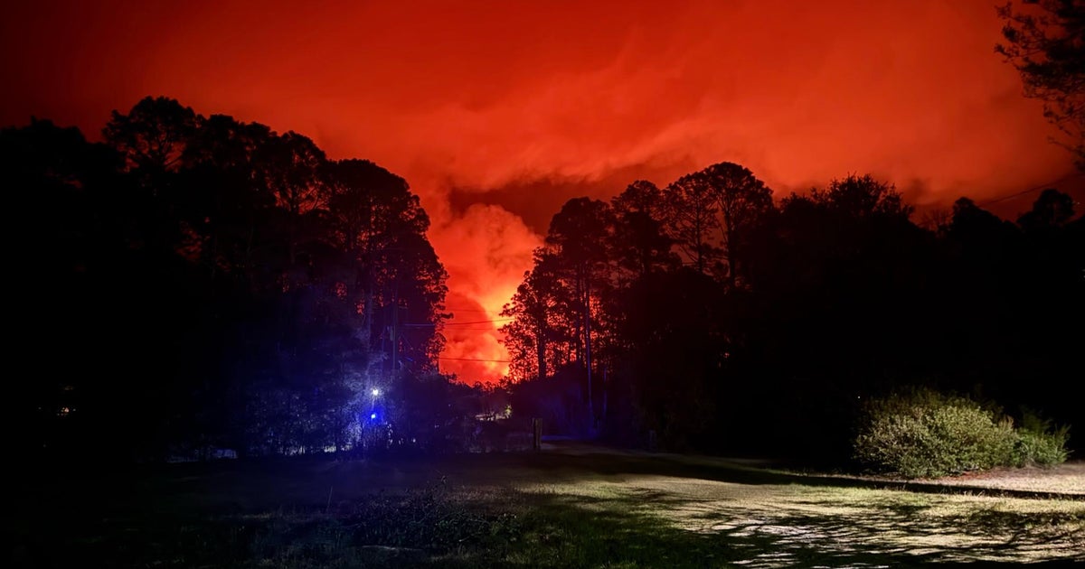
Video from Chopper 11 shows the night being lit up in an orange hue, as plumes of black smoke shoot toward the sky.
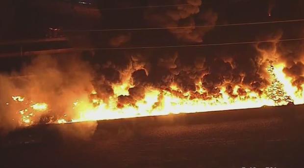
During a briefing Grand Prairie Assistant Fire Chief Bill Murray said, "The call came in right at midnight. From what we understand right now — you can see behind me there are high-tension power lines, with the towers — evidently one of the power lines fell down. All of their storage there at Poly-America, for their rolled plastic, is underneath those towers so it ignited the plastic rolls. It just spread to all the inventory that they have back there."
As it stands, firefighters are working in a defensive mode. The Latest On The Fire Here