Gradual warm-up, pleasant mornings and elevated fire risk ahead in North Texas
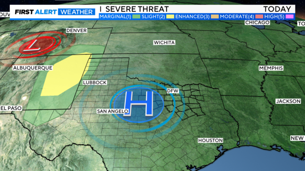
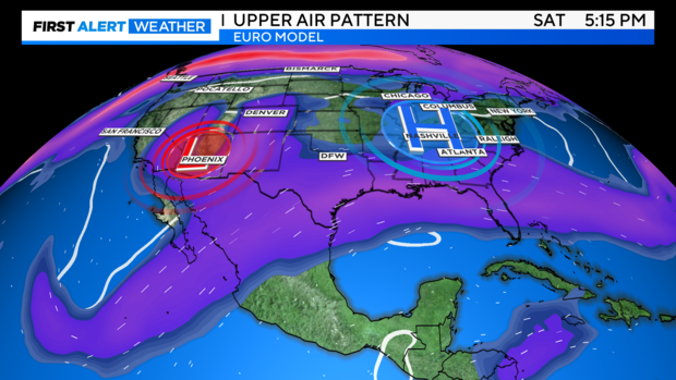
NORTH TEXAS — First, a significant trough is digging south through the Four Corners region, triggering the first severe weather of the season across the South. Some severe thunderstorms are ongoing, with a tornado threat due to adequate shear and directional shear. Fortunately, high pressure keeps this weather away from North Texas, pushing it towards Oklahoma and Kansas in the coming days.
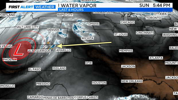
SPC has a 2/5 risk over parts of NM.
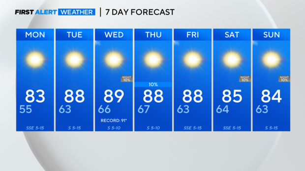
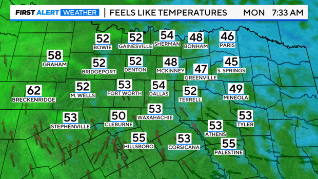
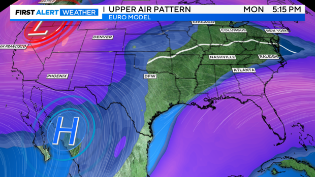
Another wonderful dip into what feels like the 40s and 50s by Monday morning!
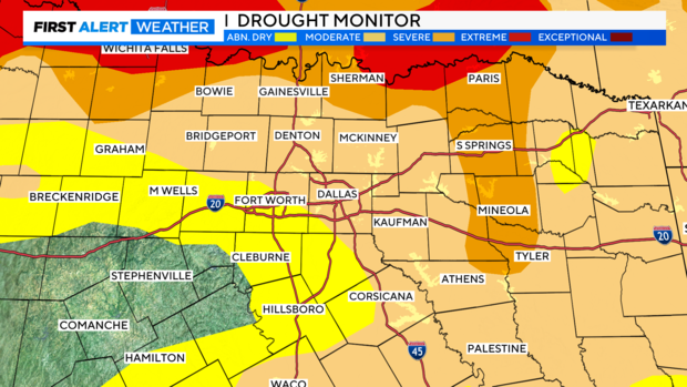
Drought Monitor: (One of my least favorite graphics, both boring and depressing). We are hurting for rain region wide.
Our upper-level pattern doesn't show much short-term help. The trough will soar over the Central Plains and head for the Northeast, leaving us with warmer temperatures into late week.
We'll be watching the week after this for the next trough. The Euro model brings it in over the Pacific Northwest and starts to drop it into the Rockies.
From there, it still seems to stay north of us on long-term deterministic guidance.
Our first real shot of a pattern change, rain-wise, appears to be near Halloween, according to the Euro model.
Have a great week!