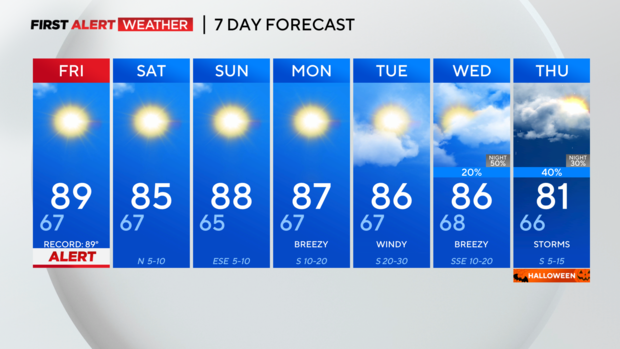
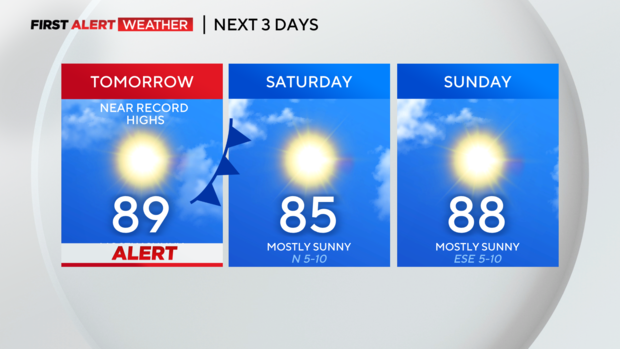
Friday is a First Alert Day for near-record heat
North Texas will see a third day of near-record heat on Friday, so we have issued a First Alert Day, making sure you are prepared for the unseasonably high temperatures.
We'll run unseasonably warm again for tomorrow afternoon, before a weak frontal boundary ushers in some relief, and slightly drier air.
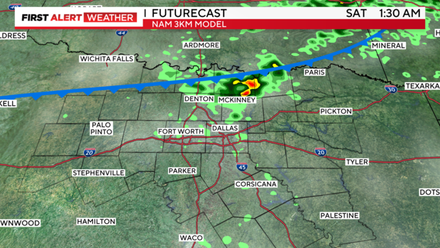
Some models have tried to produce a little activity along the frontal boundary Friday into Saturday. Although I'm skeptical of this, I can't entirely rule it out closer to the Red River.
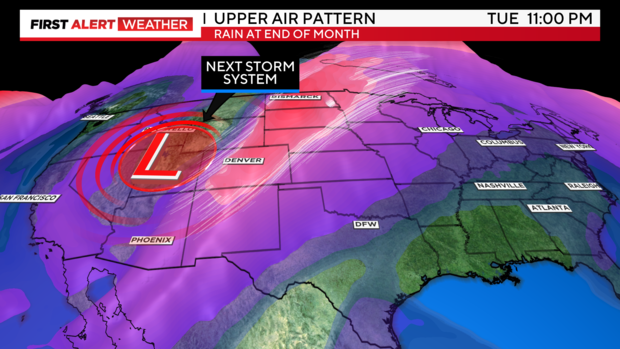
HALLOWEEN: EARLY LOOK-A spookier forecast on this one. Although I am not confident of a washout yet, a major storm system could be diving through the plains late next week, and although details still need to be ironed out, the potential is there for showers and thunderstorms, maybe even a few strong.
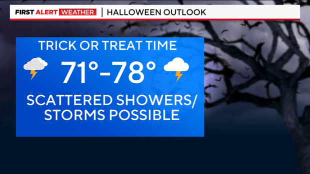
UPPER AIR: Here's the major jet stream trough that is projected to dive south across the central and southern plains by the middle of next week. With the depth and strength of this system, numerous rounds of showers and storms could be in play for the southern plains, including some organized storms and potentially a few severe. At this time, it's too early to determine instability forecasts and exact timing, so we'll want to keep a close eye as we near early next week.
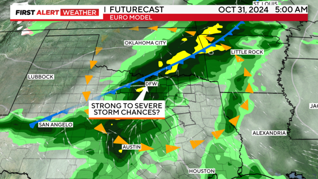
The European and American models continue to show rain chances on more than one day late next week...YAY!
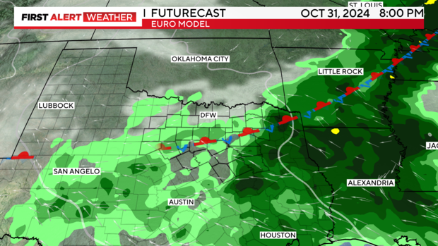
7-day forecast: don't cancel on plans for the night of Halloween yet! Timing will become more clear by early next week. 🙂