Flooding concerns ongoing for parts of North Texas with more rain on the way
NORTH TEXAS — The Weather Alert is being dropped Sunday night as severe storms move east.
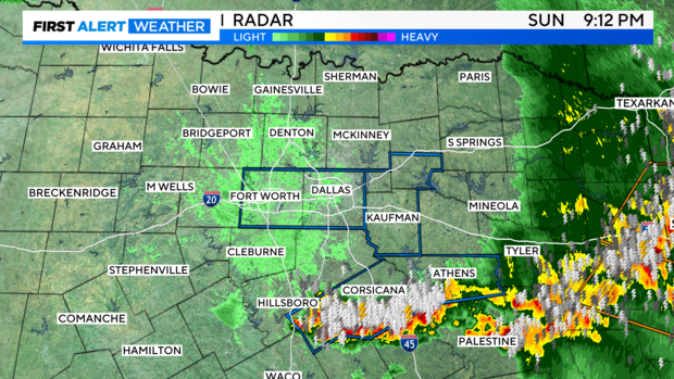
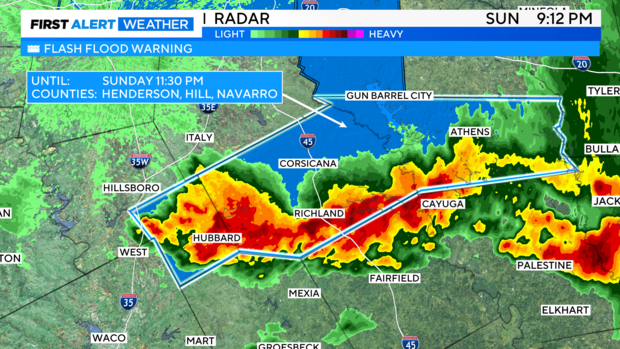
Flooding is ongoing in parts of Hill, Navarro, Henderson, and Anderson counties, but that threat is pushing south and east, as well.
Severe storms produced strong winds and some large hail Sunday. Irving was under it again earlier, with radar indications of winds up to 60 mph. Fortunately, we haven't had reports of the same kind of significant damage the northern police station experienced Saturday.
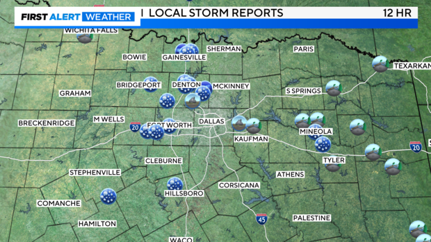
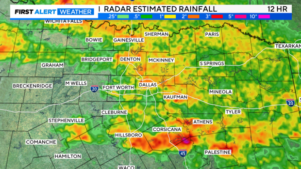
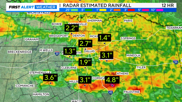
Flooding once again took the main stage though, with every metro county under a Flash Flood Warning at some point Sunday. Most spots saw 1"-2" of rain, and further south some spots likely picked up another 4"-5" of rain in a few short hours.
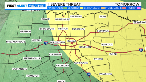
The atmosphere is significantly worked over. Once North Texas starts to heat back up on Monday, another round of scattered storms looks possible in the afternoon and evening.
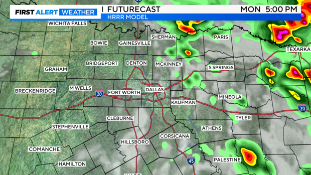
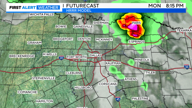
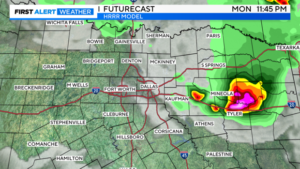
The Storm Prediction Center has areas along and east of 35 under a level 2 "slight" risk on Monday, so we'll watch this area closely.
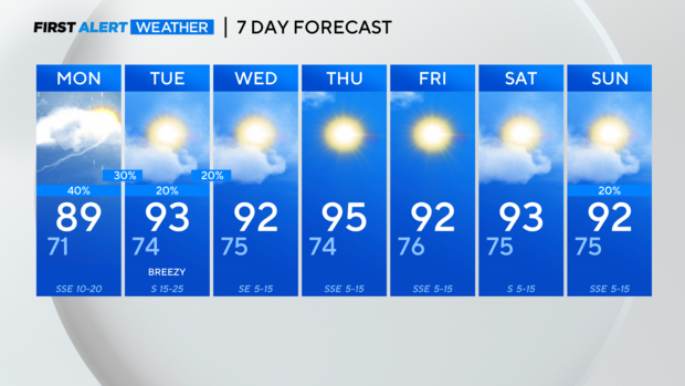
It looks like things will calm down a bit heading towards mid-week, but it'll also heat up significantly. Make sure you're staying hydrated!