Flood watch in effect as rain continues to pour down on North Texas
NORTH TEXAS (CBSNewsTexas.com) - A weather alert has been issued for this evening into Thursday morning for heavy rain, a few strong storms and the potential for flooding.
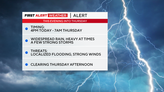
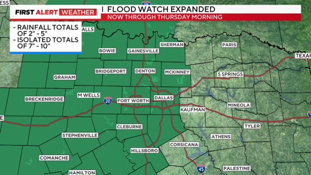
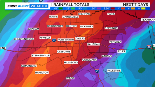
A flood watch is in effect for most of North Texas, including Collin, Dallas, Denton, Johnson and Tarrant counties. Widespread rainfall totals of 2 to 5 inches are possible with isolated 7+ inch rainfall totals.
We are expecting the highest totals to still be the farther west you are, but more significant rainfall will accumulate across all of North Texas. This is, in part, thanks to the rapid intensification of Hurricane Otis yesterday. It may not have made landfall close to us, but we will feel the impacts with more moisture and better dynamics at play.
Overnight into tomorrow is the first of likely three more widespread rounds of rain. The first being tonight, the second being Friday, and the third being the front on Sunday that'll bring the dramatic drop in temps.
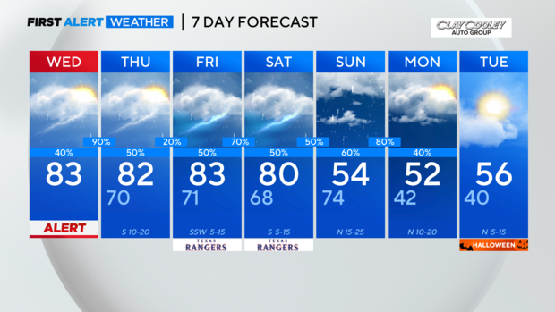
Most of the daytime hours will be dry today with cloudy skies, breezy winds, and highs in the lower 80s.
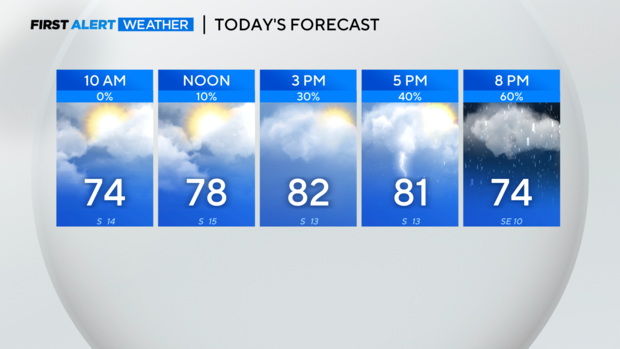
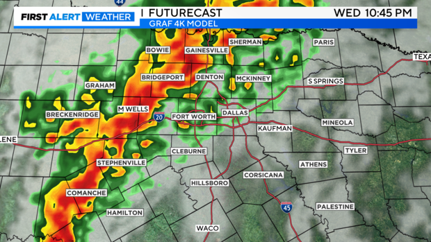
A line of storms will move east through the day arriving in our western counties around 4:00 p.m. - 5:00 p.m.
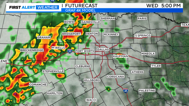
The slow moving rain and storms will finally arrive along I-35 later tonight near 10:00 p.m. - 11:00 p.m. and continue to slowly head eastward.
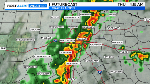
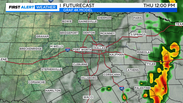
The line picks up speed around sunrise Thursday and races into East Texas, leaving drier conditions in its wake.
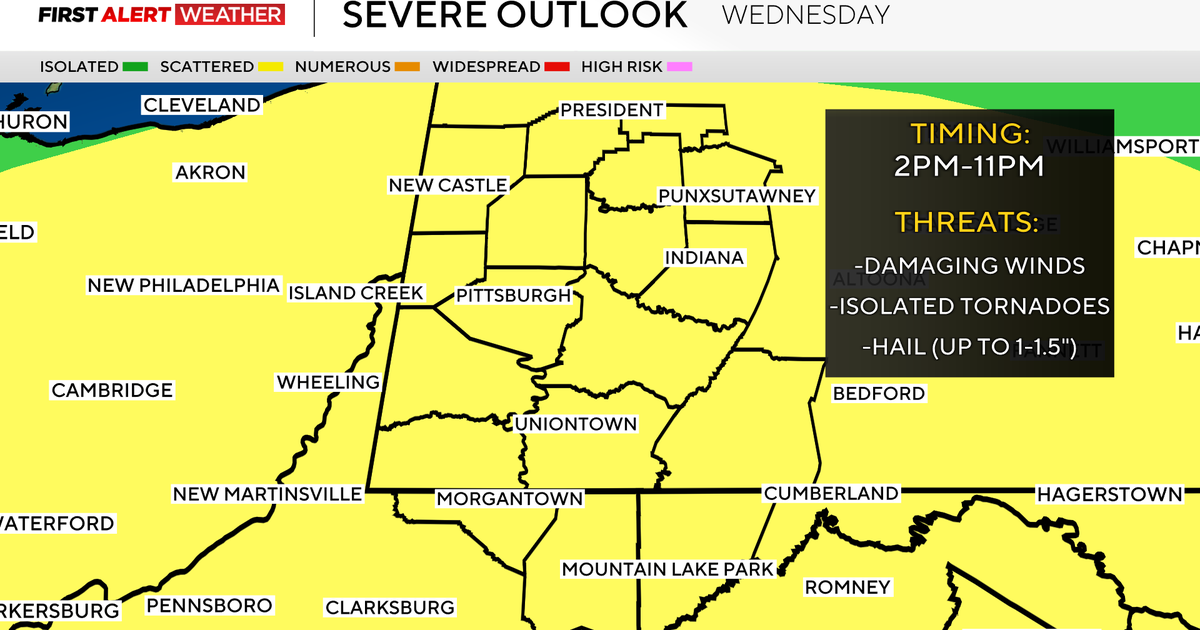
There is a marginal risk of an isolated severe storm this evening along and west of I-35 including the Metroplex. Flooding is the greatest threat, but isolated hail and strong winds are also possible.
Beneficial rain around 2-4" is possible over the next seven days. Please be mindful of the potential for flooding especially as we head into the weekend, when the ground will be more saturated.
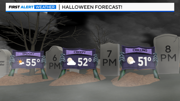
The cold air remains in place for Halloween with dry conditions. Temperatures will be in the mid to low 50s with mostly clear skies for trick or treating.
Keep the rain gear handy as multiple rounds of rain are on the way through the weekend. Then dig out the cold weather garb, with highs in the 50s and even some morning temperatures in the 30s!