Flash Flood Watch Continues As Rains Push East
FORT WORTH (CBSDFW.COM/AP) - Storms bringing moderate-to-heavy rain continue across the Metroplex and much of North Texas, well after the leading edge of torrential rain has pushed far to the east. Areas west of the Interstate-35 corridor -- including Tarrant County -- have seen some widespread rainfall amounts between two and four inches. Areas east of the Interstate-35 corridor -- including Dallas County -- have gotten between three and five inches of rain.
>> Check The Latest Conditions & Live Radar <<
This same storm system also brought severe conditions to southeast Texas stretching up north into Missouri. Areas along the storm's path have seen flooding, heavy rain, hail and at least one tornado -- reported by the National Weather Service about 25 miles southwest of San Antonio on Monday evening. Structures there were damaged and people were trapped in mobile homes, but no fatalities were reported.
The most damage we have seen locally has been due to high winds. In addition to structural damage, winds knocked out the power for thousands of customers across the DFW area. Oncor spokeswoman Ashley Burton reported that 6,000 customers were still without electricity early on Tuesday morning. Crews are working quickly -- and safely -- to restore power, but Burton provided no estimate as to how long the outages would last.
>> Check Out Severe Weather Photos <<
Showers with some moderate-to-heavy rain pockets will continue over most of the area throughout the Tuesday morning commute. There are still cloud-to-ground lightning strikes across much of the area, within the broad band of rain that spreads well behind the surface cold front, which is now in East Texas.
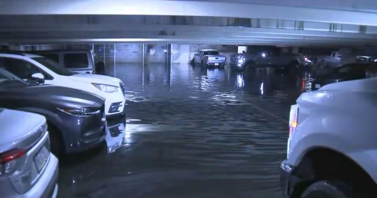
But as the rain will continue throughout the morning hours, drivers are warned to exercise extreme caution on area roads. Flooding and has led to lane closures along major highways and smaller side streets across the Metroplex including Interstate-35W in north Fort Worth and the White Rock Creek area in northeast Dallas. Those who can delay their travels until after the rush hour rains are advised to do so.
>> Check The Latest Traffic & Road Conditions <<
Travel is also being impacted at the airport, where flights were temporarily halted on Monday night at Dallas Love Field and delayed for nearly three hours at DFW International Airport. Many travelers passing through North Texas were stranded at the airports overnight, and anyone planning to fly out of the city on Tuesday is urged to check their flight status (DFW International Airport / Dallas Love Field) before leaving the house.
Most of the rain will come to a close after the Tuesday morning commute. But some showers and storms are expected to continue for East Texas and the eastern parts of North Texas throughout the day, as the cold front stalls. While we cannot rule out an occasional spot shower for those in eastern areas, most of North Texas will begin drying out under mostly cloudy skies.
Fog will start to develop during the overnight hours heading into Wednesday, and will likely become thick enough to be a major issue during the Wednesday morning commute. Clouds and spot showers will stick around on Wednesday as the upper level energy begins pushing through North Texas.
(©2012 CBS Local Media, a division of CBS Radio Inc. All Rights Reserved. This material may not be published, broadcast, rewritten, or redistributed. The Associated Press contributed to this report.)
Also Check Out: