First Alert Weather: Parts of North Texas under Severe Thunderstorm Warnings
NORTH TEXAS (CBSNewsTexas.com) - Severe weather is continuing to develop in North Texas after parts of the region saw large hail and damaging winds over the weekend.
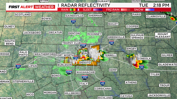
A Severe Thunderstorm Warning was issued for Kaufman County Tuesday afternoon for quarter-size hail. The isolated severe storm is moving east at 30 mph and the warning goes through 3:15 p.m.
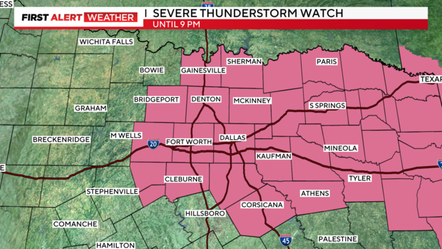
A Severe Thunderstorm Watch has been issued for most of North Texas until 9 p.m.
This is the first Severe Thunderstorm Warning for our area Tuesday afternoon, but more storm development is expected. Large hail and damaging winds will be the main threats with any storms that develop.
We will continue to track strong to severe storms on First Alert radar. There is a level 2 threat, which is slight risk, for all of North Texas. There's a level 3 threat, which has enhanced risk, for areas south of I-20 and west of I-35.
While we could use the rain, we could do with a break from the severe weather. Unfortunately, that doesn't arrive until later in the week.
A ridge of high pressure builds throughout the week, taking the high temperature to the triple digits by the end of the week. Feels-like temperatures will be 105 to 110 degrees and we will likely see heat advisories issued.


