First Alert Weather Days Sunday-Thursday due to wintry weather
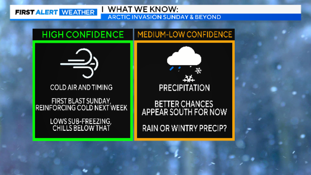
NORTH TEXAS - Confidence is increasing on the timing and temperature ranges for cold air in North Texas.
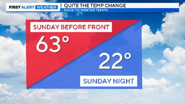
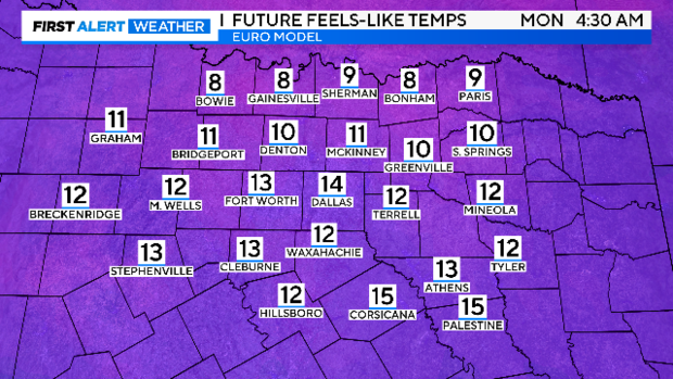
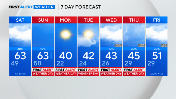
For all of us, the frontal passage should occur from mid-morning to midday Sunday, bringing gusty winds and rapidly dropping temperatures. Expect near-freezing temperatures by late afternoon, eventually reaching the lower 20s overnight into Monday morning. Wind chills will be much colder, likely in the teens, with some single digits north of the 380 corridor up to the Red River.
Confidence remains lower for precipitation late next week. However, recent model consistency and convergence suggest a slight increase in the likelihood of precipitation in the region, particularly in areas south and southwest of the immediate metro. Please note that we are still far from the event, and data will continue to fluctuate, especially regarding winter weather potential.
For different precipitation types, you need more than just certainty on cold air and moisture; you need consistency in vertical air temperature profiles. For instance, if a raindrop falls into sub-freezing air and freezes before falling into warmer air, you may have freezing rain. Many variables with wintry precipitation will come into better view when we're 48-72 hours out.
Let's start with just the first blast of cold air. This will be a shock to the body! Also, this is a fast change. By Sunday Night Football, it'll be extremely cold out there.
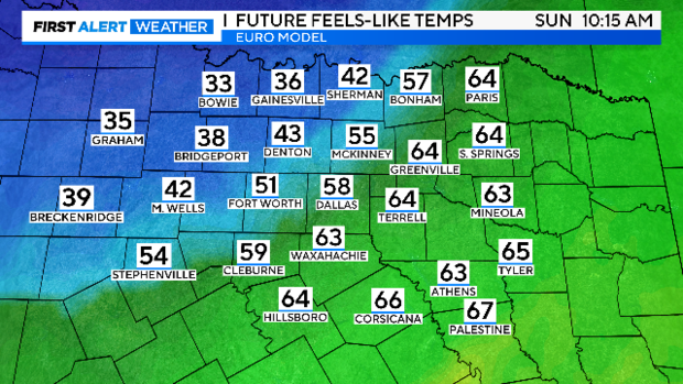
Here's the Euro's interpretation of the wind chills falling with FROPA.
Holy smokes! This one is...yikes!
Cozy up and stay warm!
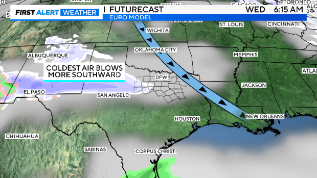
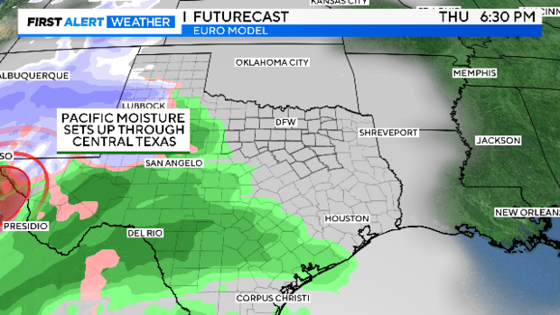
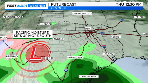
Now, to the harder forecast. I am making no determination apart from showing some of the major models' projections and discussing them on-air. Each of these major models has runs every six hours, and the data continues to change. However, a few trends have been evident: more Pacific-drawn moisture appears to be entering the state of Texas, along with super cold temperatures.
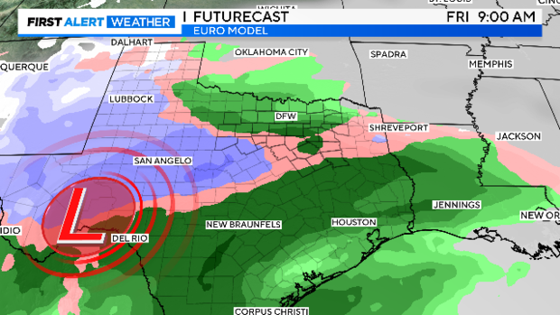
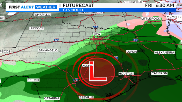
The EURO's main runs continue to trend towards a large plume, Pacific low developing over far west Texas and drawing on both Pacific and Gulf available moisture into the state late next week. This has the potential to create ALL forms of precipitation across the state, depending on those temperature profiles AND timing. The latter two are still variable at this time.
If the latest Euro trends and ensemble of models end up verifying, or at least are pointing in the right direction, then we could see a mix of precipitation and possibly some snow late week! There are still so many variables that can and WILL change. Stay tuned.
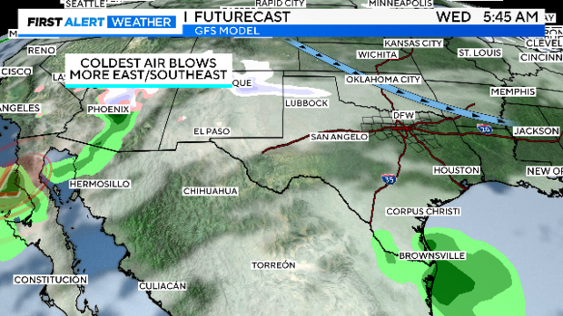
The GFS (American) model has just recently trended AWAY from wintry precip and towards slightly warmer air, producing more rain. However, this was primarily only on intermediary runs, and they have a habit during winter months of sometimes underestimating colder vertical temperature profiles, especially in a setup like this, originating with more Pacific moisture. Still, there's just a LOT of uncertainty this far out.
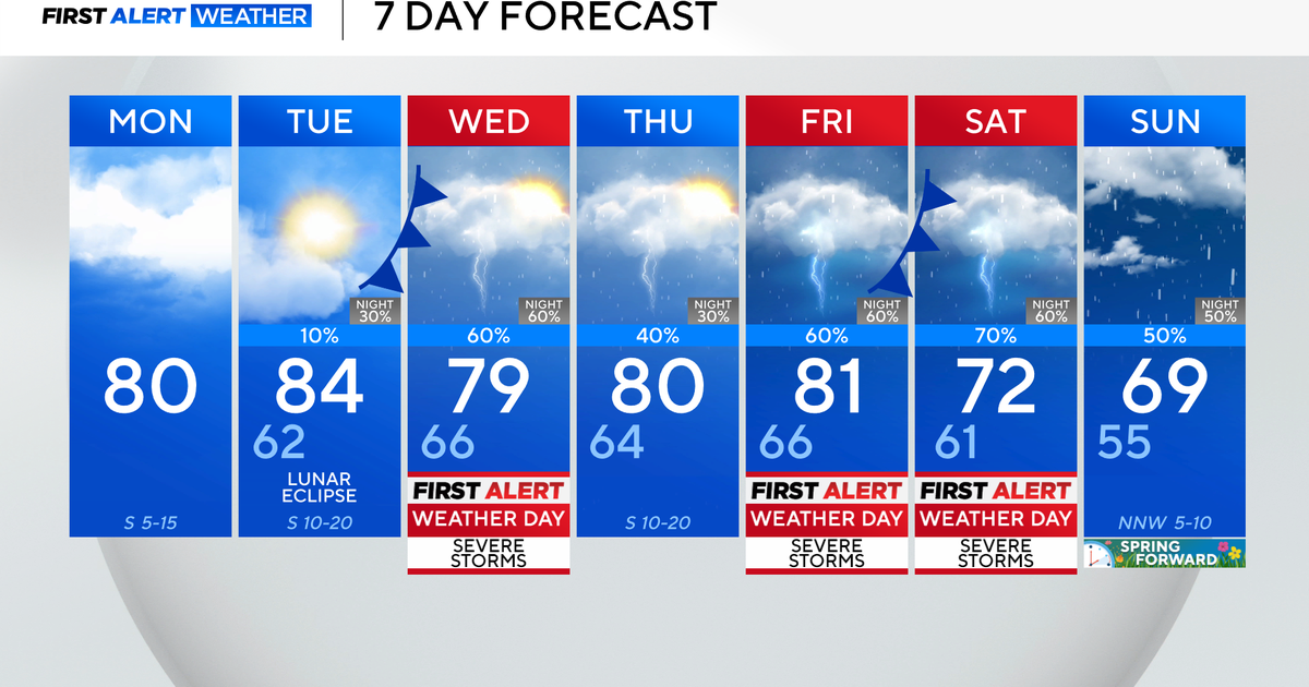
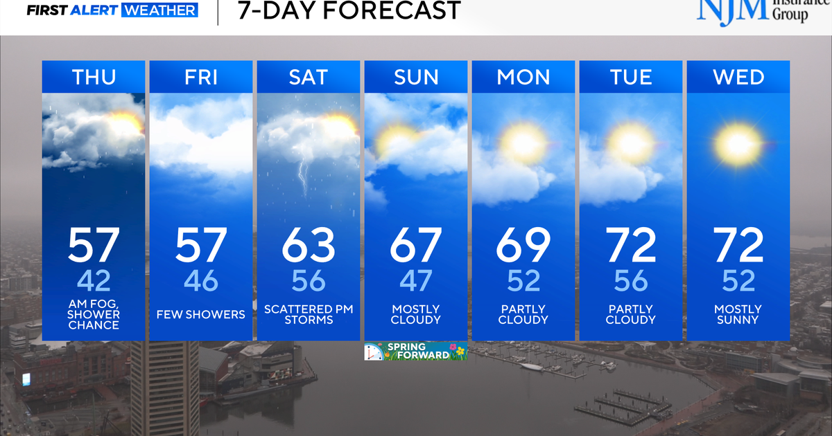
7-day forecast:
(I expect us to know much more within that 48-72 hour window).
