First Alert Weather Day issued for Wednesday, strong to severe storms possible
NORTH TEXAS (CBSDFW.COM) – A First Alert Weather Day has been issued for Wednesday. With a strong cold front approaching late Wednesday evening, there's the chance for some storm development in the afternoon and evening.
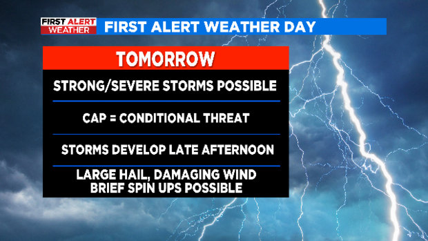
This is a conditional threat day. A strong CAP is expected to be in place. Some of the models suggest the CAP will hold, but if it erodes or a storm can break through it then all types of severe weather would be possible. The main concern is large hail and damaging winds, and an isolated tornado can't be ruled out either. While some brief heavy rain might be possible with an individual storm, the overall flooding threat is low.
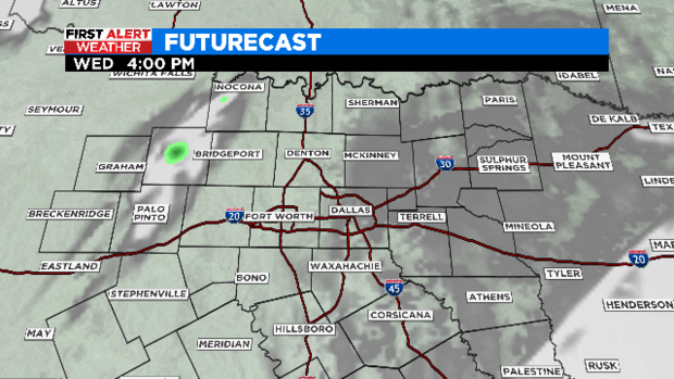
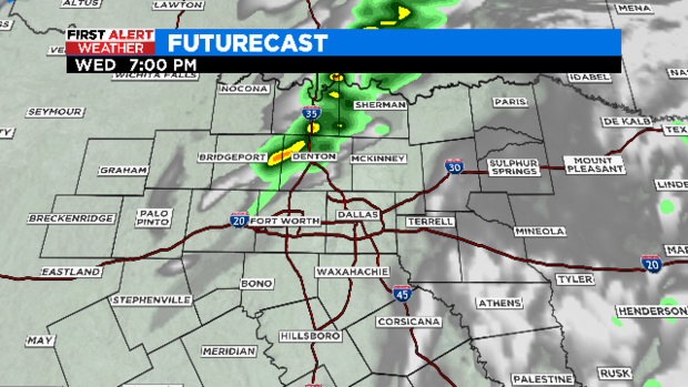
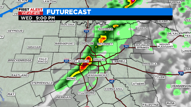
We'll watch for storm development to the west starting around 4 p.m. Wednesday. If storms can get going, we'll see more activity through the early evening hours to the north of I-20 and along I-35.
This is the HRRR model, one of the more aggressive in showing storm activity on Wednesday.
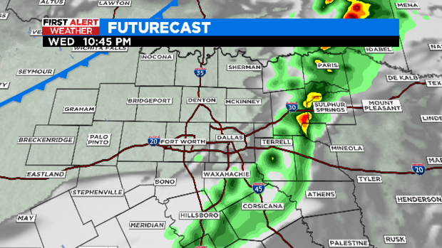
I would expect any activity to be east of most of us by 11 p.m. Wednesday.
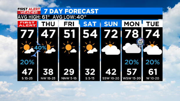
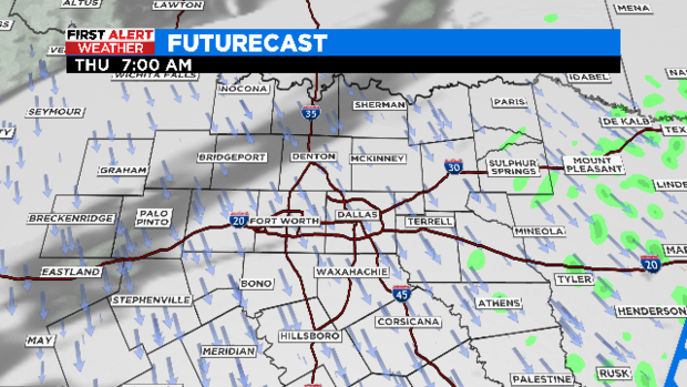
Then it's all about the cold and wind by Thursday.
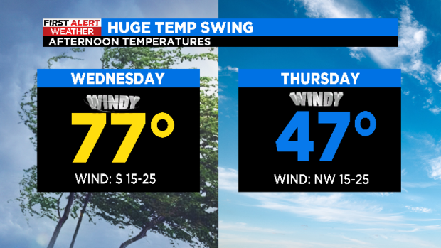
It'll be a 30 degree temperature drop between Wednesday and Thursday. And with winds out of the northwest at 15-25 mph on Thursday, feels like temps will be in the 30s.
While it'll remain below normal for Friday and into the first half of the weekend, the forecast definitely improves. By Sunday we're back to the low 70s!