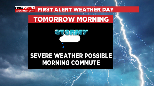
First Alert Weather: Damaging winds and hail move into DFW overnight
NORTH TEXAS (CBSDFW.COM) – A First Alert Weather Day has been issued as damaging winds and hail is expected to move into North Texas during the morning commute.
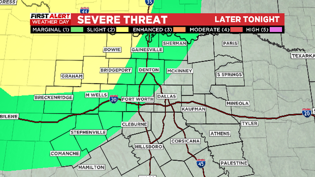
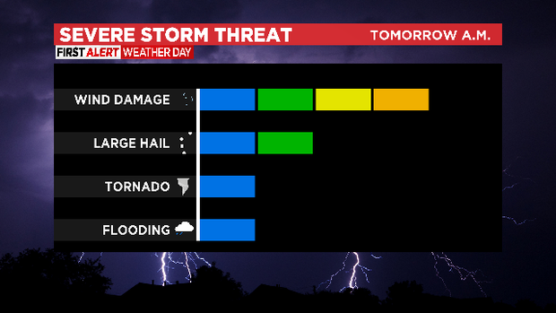
What we are watching: Damaging winds and hail the primary threats, quick spin tornadoes a small risk.
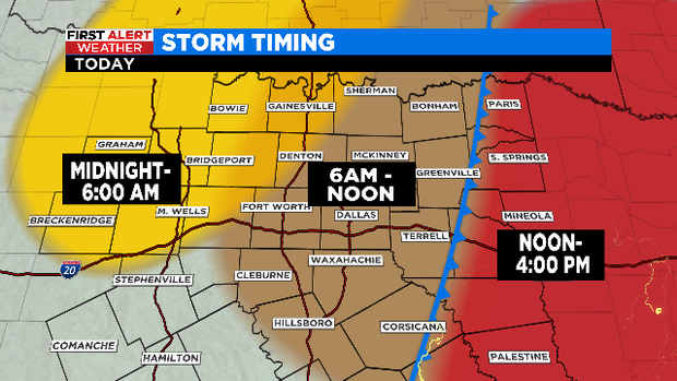
The weather-worry starts after midnight. The winds will really start to howl overnight and during the morning:
We'll see the threat start after midnight in our west, northwest area of North Texas:
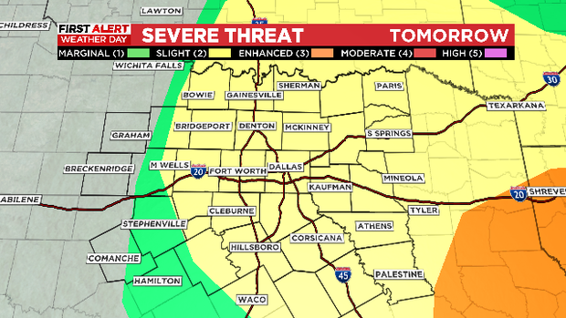
By early morning and up to noon, the risk is over North Texas:
We are expecting a line of strong storms to arrive in the Metroplex during the morning commute. Damaging winds will be the primary threat, but hail and even weak, short-lived tornadoes are possible.
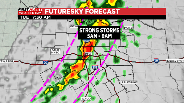
These storms will be moving west to east and are expected to exit north Texas by early afternoon. The risk of severe weather is higher in our eastern counties than over the Metro area:
Winds over 60mph are possible. Hail 1" or larger is the 2nd highest risk:
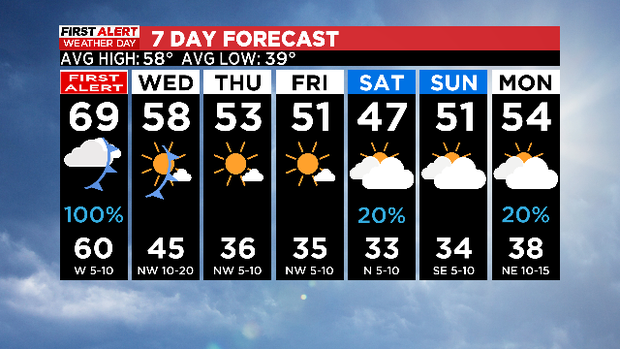
The storms should move out by early afternoon. We'll likely see some sunshine by end of day. A second front moves across us on Wednesday, this one comes from the cold north. Expect much colder days rest of the week as we finally get a dry spell in December. This cold air is expected to stay in place across Christmas.