Expect record highs & a grass fire threat the next several days
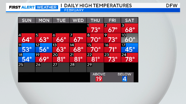
Temperatures reached the upper 70s on Saturday. An even warmer Sunday is expected.
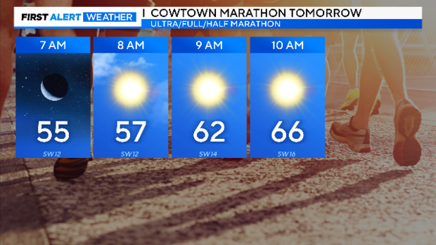
Fort Worth Cowtown Marathon race officials are warning runners about the unusually warm morning ahead. Your typical low this time of year is in the low 40s. Instead, it'll be closer to the typical high by mid-morning.
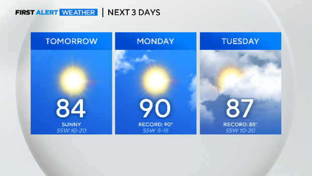
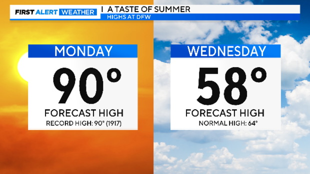
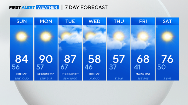
Expect a breezy day Sunday, Monday and Tuesday. The southwest winds and sunshine expect to get us to record territory.
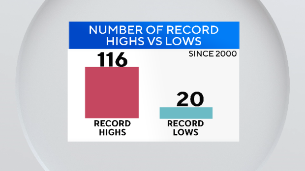
Since we started the new century, DFW has logged six times the number of record highs than record lows.
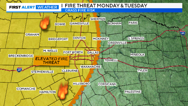
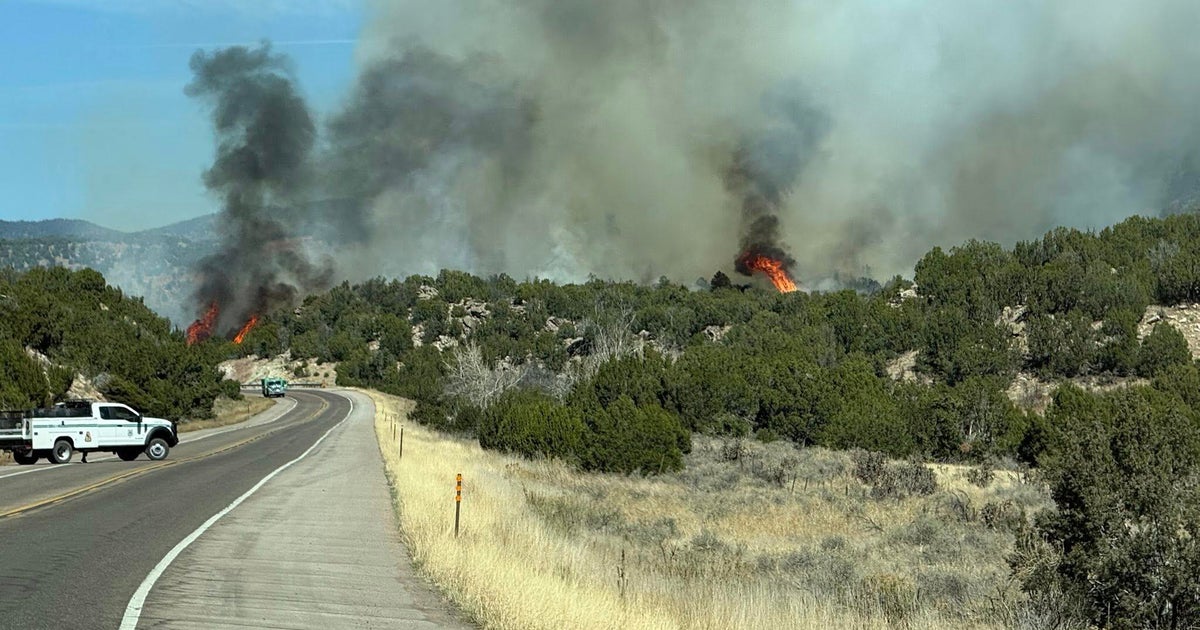
With the strong winds, dry air and dry conditions we need to be vigilant to grass fire risk.
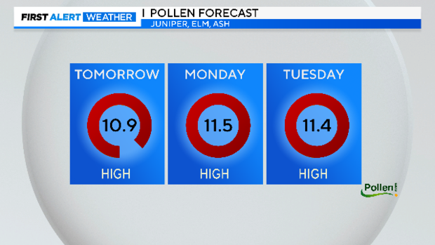
These strong southwest winds are also pumping up the mountain cedar, juniper, number. The majority of the pollen travels here from the Hill Country. This problem will persist until mid-week.
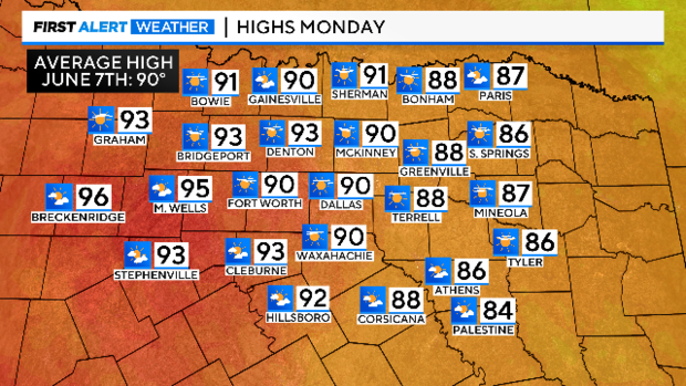
Highs Monday promise to be the highest this winter. The average high a week into June is 90 degrees.
A cold front arrives Tuesday night. It will bring modest rain chances and much cooler temperatures.
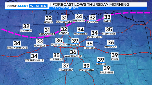
By Thursday morning some areas are expected to be below freezing.
We'll end the last two days of meteorological winter with below-normal highs ironically. To date, this is the fifth warmest February on record.
Right now it's the 15th warmest winter on record. Half of the Top 20 warmest winters in the 125-year history have occurred since 2000.
Here is your seven-day forecast. We'll climb out of the cold rather quickly as we start March on Friday.
