Expect more showers and storms with another front in North Texas
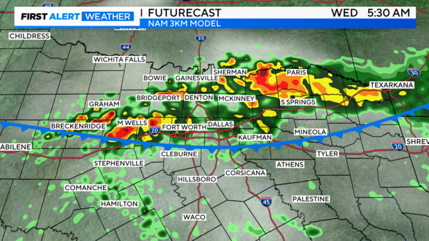
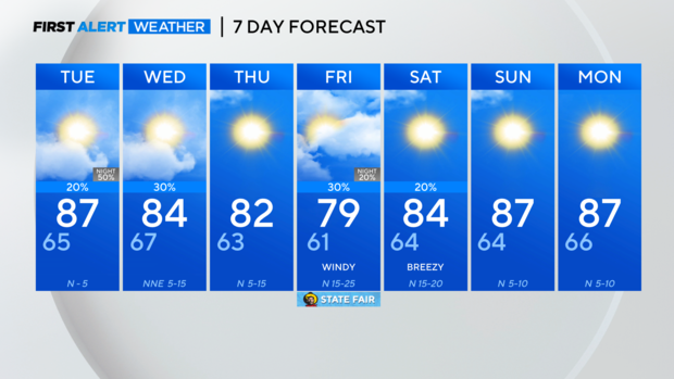
NORTH TEXAS — First, our next front will approach late Monday through Wednesday morning. Along with this frontal passage will be showers and thunderstorms, some of which may contain heavy rain.
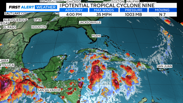
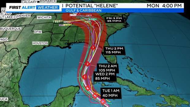
Potential Tropical Cyclone Nine is now forecast to become a major Category 3 hurricane by Thursday and make landfall in the Florida Panhandle.
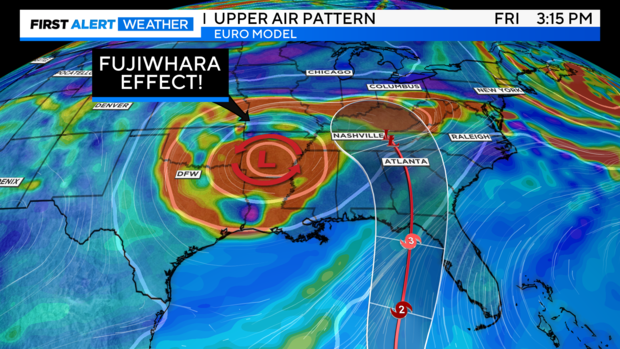
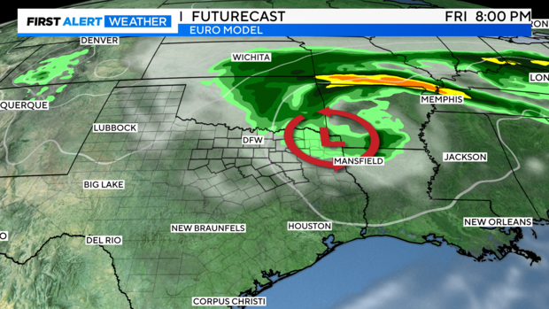
Something unique will occur with the upper levels after Helene makes landfall. The "Fujiwhara Effect" could occur, where the upper low and the cyclone orbit one another and merge over the southern United States. This will keep unsettled weather over us through the weekend.
Watching rain chances for the first weekend of the state fair. As of now, still a low chance due to some wrap-around moisture, but the recent model trends are trying to push this activity eastward. Let's hope that holds.
