Rain chances vanish, near-record temperatures expected into next week
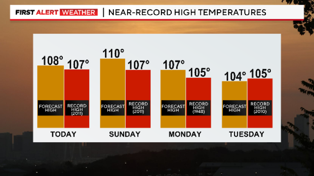
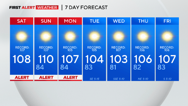
NORTH TEXAS (CBSNewsTexas.com) - We are off to a warm start with temperatures still in the low to mid-80s under sunny skies. Weather Alerts continue through Monday for near-record temperatures and dangerous heat.
Sunday will be our hottest of the next 7 days with highs in DFW near 110 degrees!
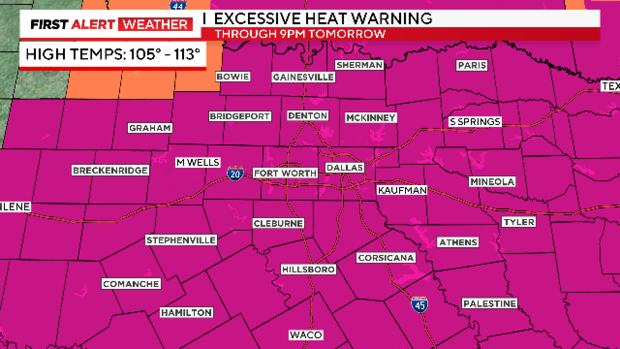
The Excessive Heat Warning continues for North Texas through tomorrow evening at 9 pm. It will likely be extended into Monday as well.
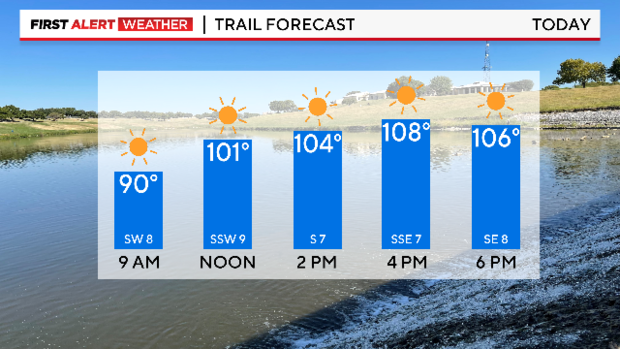
If you were planning a trail walk or bike ride, the earlier the better. By noon, we will be in the triple digits and will see highs in DFW around 108 with light southwesterly winds.
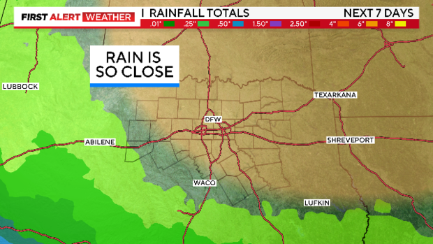
No rainfall is in sight for us in North Texas as the ridge of high pressure remains in control of our weather. While the high pressure moves north, our heat sticks around and any rain chances diminish.
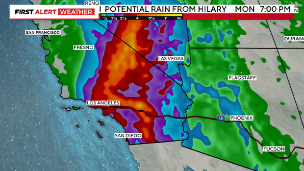
But we are also keeping an eye on Hurricane Hilary in the Pacific.
The storm is expected to weaken to a tropical storm as it nears southern California overnight bringing flooding rain of 3'-6" and tropical storm-force winds through Sunday.
Back here in our part of the woods, the heat dome over the southern plains will gradually shift a little further north early next week allowing gulf moisture to move into central and southern Texas.
Unfortunately, the ridge of high pressure will continue to keep North Texas dry.
We are now at 34 days without rain and the drought conditions continue to worsen, so our fire danger will remain elevated for the foreseeable future.
