Stretch of excessive heat, triple-digit temperatures ahead for North Texas
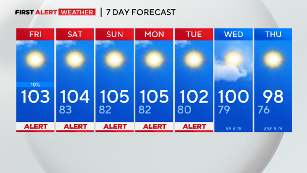
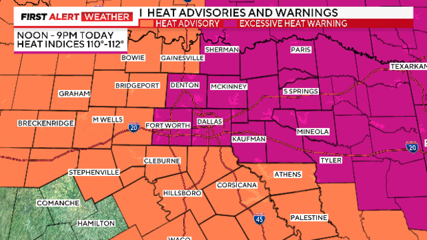
NORTH TEXAS – The hottest days of the year are on the way to Dallas-Fort Worth this weekend, including a stretch of excessive heat. The weather alerts from CBS News Texas are in place Friday through Tuesday – that is five consecutive days of alerts in place.
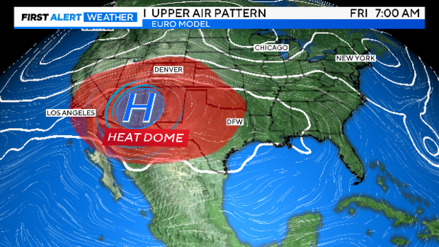
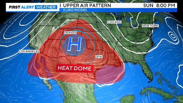
The high-pressure ridge out west continues building towards the east the next few days and will bake North Texas even more from Sunday to Monday.
The heat dome expands through the weekend and into next week, which keeps high temperatures in the triple digits for an extended stretch.
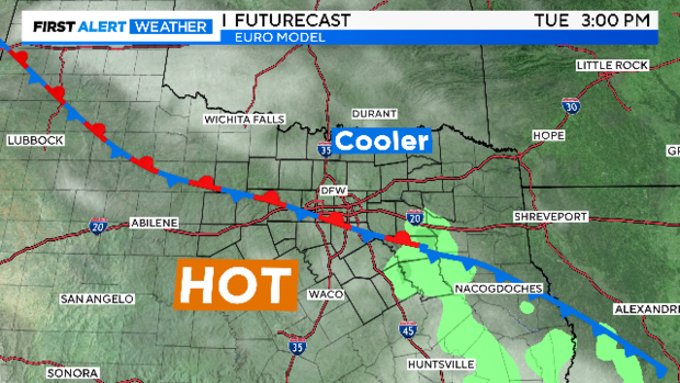
By late Wednesday, the ridge shifts west and North Texas is on the eastern edge. This weakness allows a surface front to slide into North Texas late Tuesday into Wednesday. With the slightly cooler temps in the forecast, CBS News Texas meteorologists dropped the weather alert for Wednesday. High temperatures drop to 100 degrees and then into the upper 90s by Thursday.
The European forecast model brings some spotty showers into the forecast Tuesday night into Wednesday but there isn't a high confidence that is going to happen so don't expect any precipitation.
The heat alerts are in place Friday for North Texans as the heat is in full force. A heat advisory is in place for all of North Texas until 9 p.m. At noon, an excessive heat warning is in effect for the Dallas-Fort Worth Metroplex and all the counties in pink.
Dangerous "feels-like" temperatures are in the forecast through the weekend where some spots could feel up to 112 degrees. Be sure to limit time spent outside and expect these alerts to continue into next week.

