Elevated fire threat, strong winds continue in North Texas throughout the week
Elevated to critical fire conditions and high winds push on into this weekend.
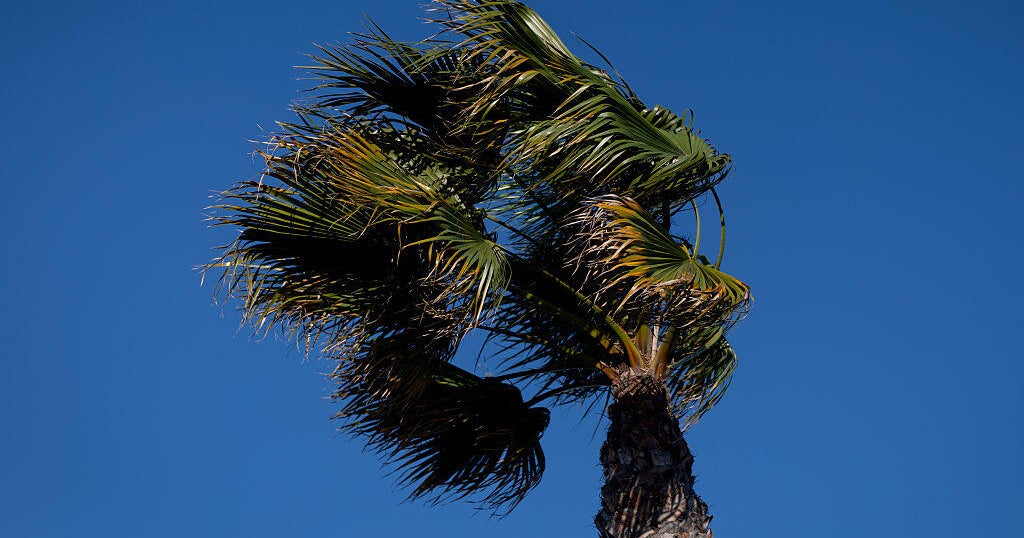
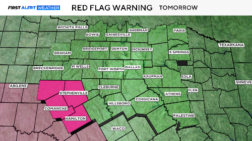
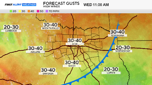
Red flag warnings continue for the western portions of North Texas. Gusts up to 45 mph with extremely low humidity making for dangerous fire conditions.
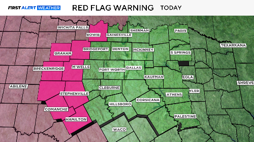
The red flag warning for Wednesday only covers the southwest corner of North Texas. It continues until 9 p.m.
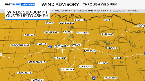
A wind advisory covers all of North Texas. It continues through 9 p.m. Wednesday. Expect sustained winds from 20-30 mph with gusts as high as 45 mph.
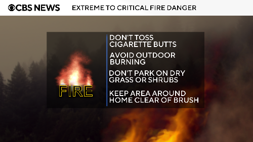
Please be careful out there. Secure outdoor items. Don't drive too close to high-profile vehicles. Avoid any outdoor fires of any kind, including cigarettes.
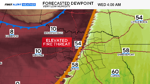
There is a dryline coming through Wednesday morning, dropping the dewpoints down close to single digits. This only increases the fire danger by drying out vegetation. A cold front arrives later in the morning to get us out of the 80s for a while.
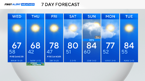
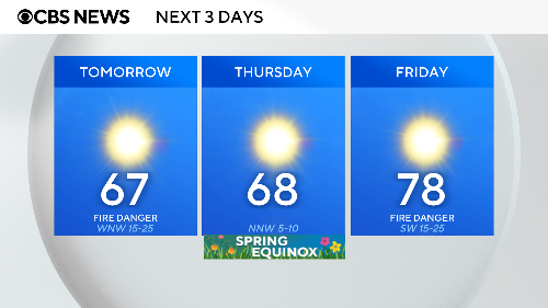
The fire danger remains high on Wednesday because of strong winds. Those winds die down on the first day of spring making for a great day. Morning lows start in the low 40s, so have your jacket ready.
Expect strong winds Wednesday afternoon, they won't start to diminish until the overnight hours going into Thursday.
Winds pick back up on Friday and we go right back to high fire risk.
We'll be in the 80s for the weekend with a cold front arriving sometime Sunday afternoon. Severe weather is possible, but storm coverage could be confined to just our eastern counties. The First Alert Weather Team will continue to update you on this risk on Sunday.