High winds, fire risk continue in North Texas as a red flag warning starts the week
Though Sunday started off cool, the afternoon highs will top out seasonably in the upper 60s and lower 70s. Winds will be mild, coming from the north around 5 to 10 mph, before a red flag warning takes effect late Monday morning.
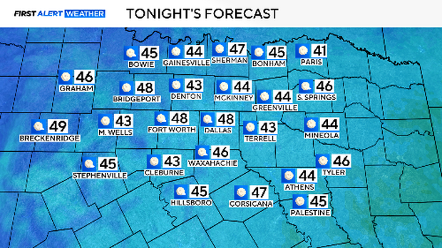
Monday morning won't be as cold as Sunday, but it will be in the 40s, nonetheless.
The weather problem is simple. We haven't had much rain so far this spring and the last time it rained was a week ago. The ground is dry because of a series of windstorms teamed with low humidity, pulling moisture out of the soil and plants. We've logged 10 days where the high got into the 80s since the year started, another efficient way to dry the ground and vegetation.
Until we get some rain, any time the wind picks up, we worry about fire danger.
Monday, winds will be out of the south around 20 mph with gusts up to 35 mph. Humidity will again be extremely low.
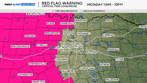
A red flag warning is in effect Monday from 11 a.m. to 10 p.m. for our western half, including Wise, Parker and Hood counties.
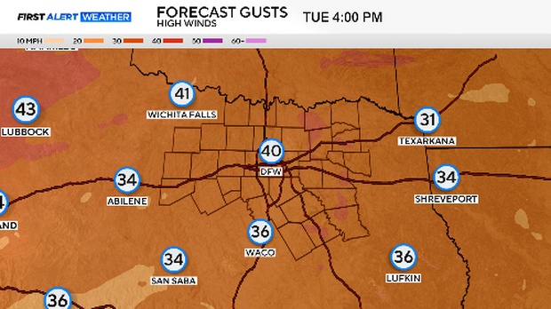
Sustained winds and wind gusts are expected to be higher on Tuesday and Wednesday.
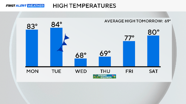
Despite the cold start Monday, temperatures will leap to the low 80s from the dry air and warming winds. It will be another hot day on Tuesday before a cold front comes through Wednesday morning.
This front won't bring rain, just a few clouds with strong north winds in its wake. The air will be even drier, making for an enhanced fire risk on Wednesday.
Temperatures will get knocked back down to "typical". We'll have a nice day on the Equinox on Thursday. Fire danger comes right back on Friday as winds pick up again.
We're expecting red flag warnings on Tuesday, Wednesday, and Friday. There is a chance of rain next Sunday, but it is not looking that promising.

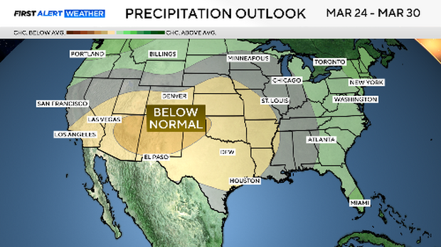
In fact, the outlook for the last days of March is a good chance of below normal rainfall. We need rain. We are getting wind and dust instead.
Here is the 7-day forecast. Please, no outside burning. No tossing cigarette butts out the car window. Don't park over dry grass. No welding outside. Don't drag tow chains.
We all must be very careful over the week ahead not to start any fires. They could spread very quickly. One spread through Stillwater, Oklahoma, last Friday and burned down 50 homes in one afternoon.


