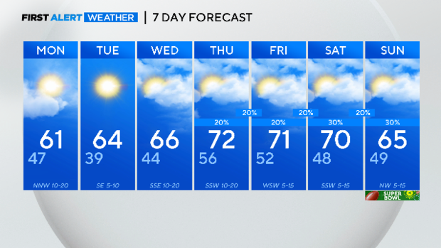
Dry, warm start to the week before rain chances return
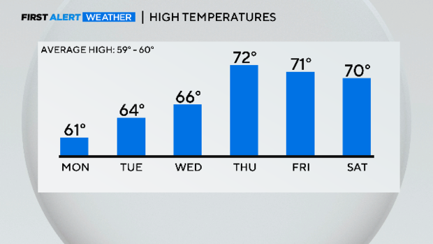
NORTH TEXAS - There was enough sunshine Sunday to get temperatures into the mid-60s. Passing showers were the story of the afternoon/early evening. While there is a small chance of some rain Sunday evening and overnight, we'll awake Monday with just some clouds still around from all this. It'll be breezy as the skies clear in the afternoon. Temperatures will be slightly warmer on Tuesday and Wednesday.
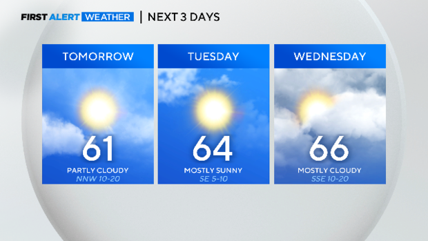
Rain chances return on Thursday as winds pick up from the south. Highs will get into the 70s like they did last week, well above normal for this time of year.
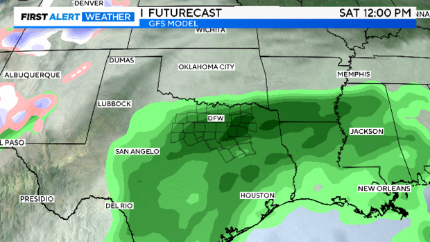
We are going to get back into the wet pattern to close the work week and into the weekend. Several small disturbances are expected to pass over North Texas in rapid succession.
This puts persistent rain chances in the daily forecast. Timing is still very much in the air and overall chances any one day look modest. All this is subject to change as we draw closer:
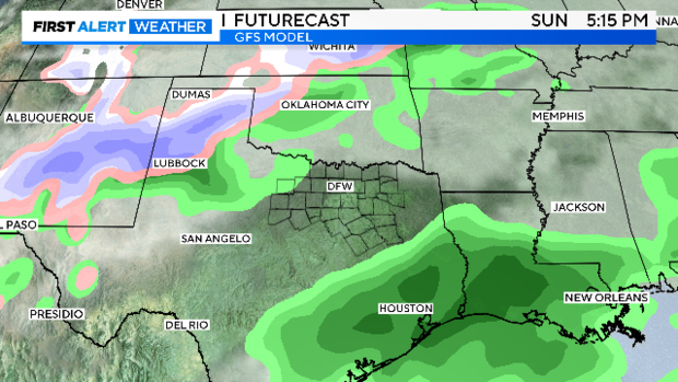
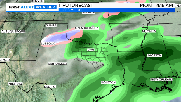
Rain chances show up on Thursday. Models agree, currently, that Saturday has the highest rain chance.
Saturday night :
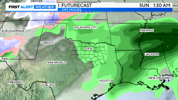
Sunday around kick-off:
Long-range models put snow in the Texas Panhandle next Monday, Feb. 12. There is a chance it could end up closer to us.
Interesting to see the long-range weather pattern start to hint at the return of cold weather. While the worst of this cold will likely end up on the East Coast, there are good chances of below-normal temperatures by mid-month.
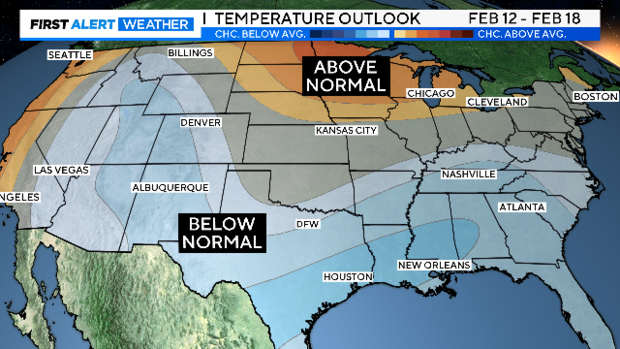
This could be just the start of a 2-3 week run of cold weather. I've seen this pattern before showing up in February. A ridge builds up on the west coast and extends all the way up close to Alaska. This dislodges poler air south across the heartland. This happened earlier in the month in February 2010 and delivered a foot of snow, the second biggest snow event in DFW history, and the sixth coldest February ever.
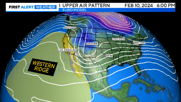
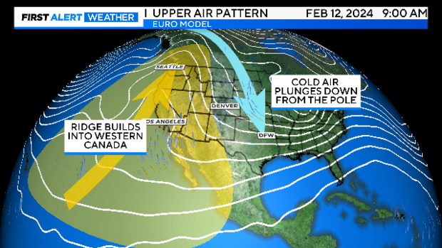
Needless to say, we'll continue to watch this. There are strong teleconnection signals, persistent weather patterns over the oceans that affect the weather here, that hint of some cold weather to close winter with.
This would be cold weather here by the second half of the month. Here is your 7-Day: