DFW Weather: Severe Storms, Hail, Tornadoes Possible This Easter Weekend
NORTH TEXAS (CBSDFW.COM) — Severe weather is threatening North Texas this Easter weekend.
Here is the Storm Prediction Center's storm outlook for today:
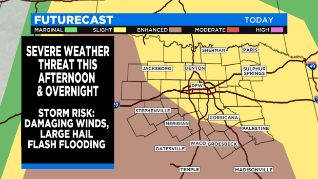
Severe weather is possible starting Saturday afternoon and going in to Easter morning.
There is a slight risk (yellow) for the Metroplex and north and an "enhanced" risk (brown) for the southern third.
Almost all areas could see large hail, damaging winds and flash flooding. Our southern counties could also see isolated tornadoes.
For the afternoon, most of the stormy weather will be along the I-30 corridor and north. These storms will start to from the west and expand as they move over the Red River counties. Flash flooding and small hail are the main risks.
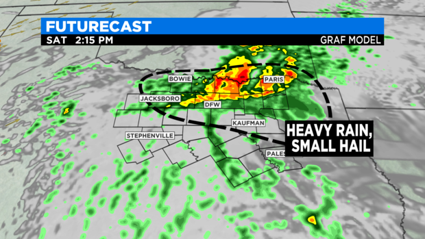
North Texans will have to watch the dry line to the west for storm development. These storms could produce large hail up to 3 inches in diameter as will as winds up to 70 mph.
These storms will likely stay just west of the Metroplex but will have to be watched.
Anyone in Young, Stephens, Palo Pinto, Parker or Jack County are advised to stay weather aware this afternoon and early evening.
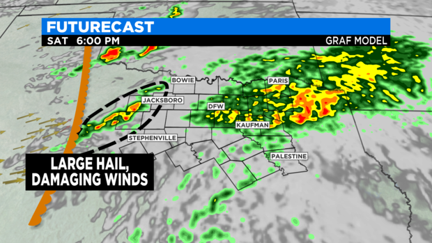
Another round of storms will come up from the southwest and the Hill country later tonight.
Storms that develop along and south of a slow moving warm front will have to be watched for possible tornadoes.
If the warm front reaches into the Metroplex (Currently the forecast is for it to stay just south of DFW) then the threat of severe weather increases dramatically for Tarrant and Dallas counties.
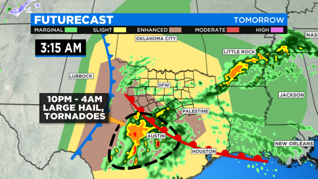
Flooding, large hail and isolated tornadoes are possible. Here is where these storms are forecast to be by early morning on Easter:
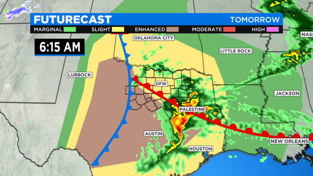
Much could change to this forecast concerning what happens overnight. The motion and position of the warm front is critical in where they worst of the storms will take place.
There could be some significant rain with these waves of strong to severe storms North Texas is expecting over the next 24 hours. All of North Texas faces a slight risk of excessive rainfall.
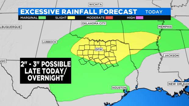
Some areas could get two to three inches of rain. This is one of the wettest starts to a year on record in North Texas with over 16 inches since Jan. 1.
North Texas could again see rivers reach over their banks tonight and tomorrow so travelers are advised to be careful driving tonight or early morning tomorrow since localized flooding is possible.
ANOTHER ROLLER COASTER RIDE
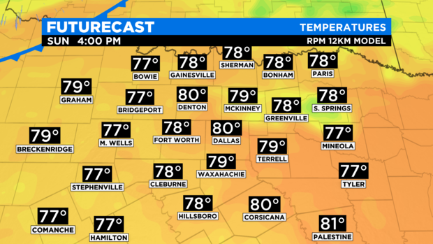
A strange thing happens on Easter. A dry-line and a pacific cold front move through late morning. This will completely change the weather.
North Texas will go from clouds and storms to sunshine and brisk winds. These west winds could hit 25 mph and have temperatures quickly climb to around 80 degrees.
But this only sets the stage for another big shocking change of weather. Winter is coming.
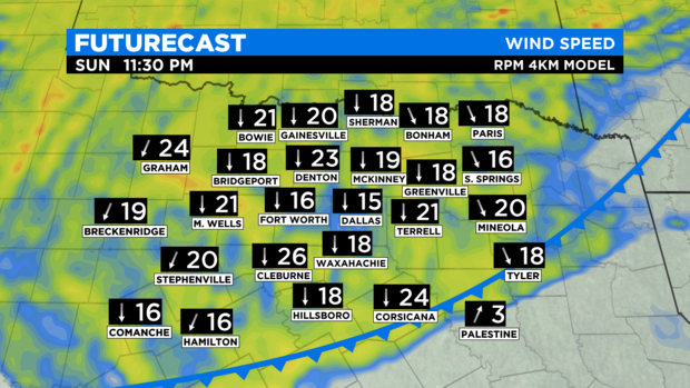
Late Sunday night, winds will turn to the north as a strong northern cold front will sweep across North Texas. A wind advisory might be needed as gusts could hit 35 mph or more overnight into Monday morning.
Temperatures will plummet down to the upper 30s by Monday morning. Factor in the wind and the feel-like temperatures will get down to the upper 20s in some spots.

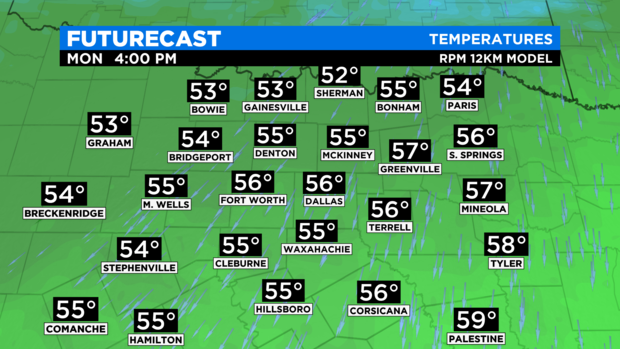
Highs on Monday will only be in the mid 50s, about 25 degrees colder than Sunday.
Stay tuned to CBS 11 for more weather updates this weekend.


