Dangerously cold arctic front moves into North Texas after a beautiful week
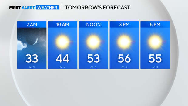
NORTH TEXAS — Lows Tuesday morning were in the 20s and lows Wednesday are expected to be in the 30s, an improvement but it's still cold.
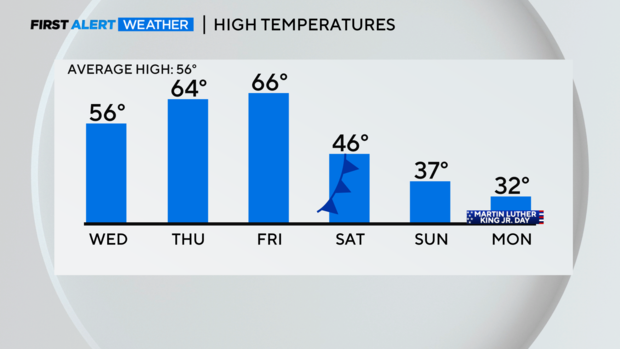
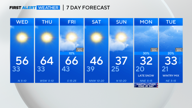
North Texas should see highs rebound into the 60s on Thursday and Friday, but it's short-lived. An arctic front will push through overnight Friday and by Saturday morning North Texas will feel the impacts.
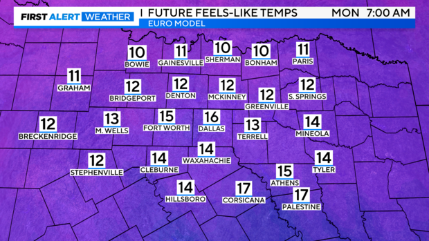
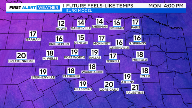
Afternoon highs continue to drop day after day starting this weekend and continuing through early next week. It will be very windy behind this front, which means the wind-chills will get into dangerous territory – particularly on Monday.
Notice Monday morning when wind chills will be in the low teens and potentially single digits for some. Compare that to Monday afternoon… not much improvement.
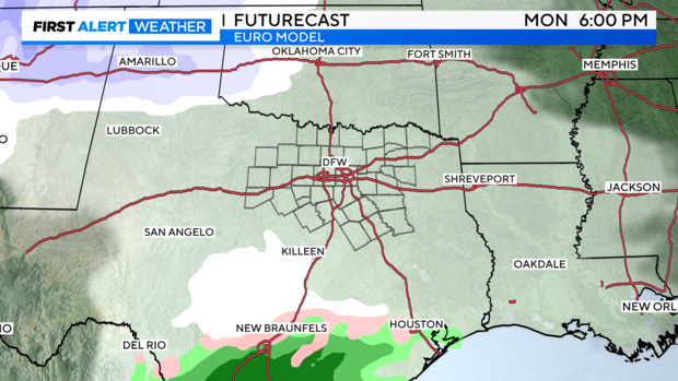
It's going to get cold, but what could the precip forecast look like? As of Tuesday afternoon, models are trending slightly into more agreement on a wetter forecast but there's still a lot to be ironed out.
Right now, there is a 20-30% probability of precipitation starting Monday and continuing into Tuesday. It'll certainly be cold enough, but there's still a question of whether we'll have enough moisture to work with in North Texas. Moisture looks more plentiful in Central Texas. Flurries would start late Monday and continue into Tuesday; Tuesday's coverage would pick up.
