Dangerous heat in North Texas may bring about alerts
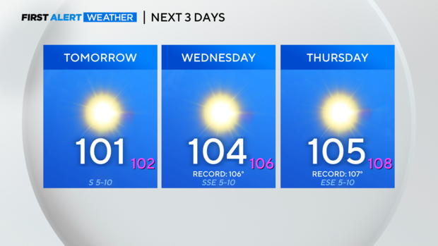
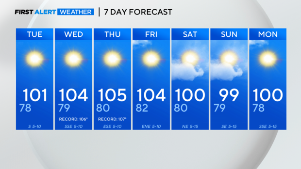
NORTH TEXAS — High pressure will build in from the west over the next few days, not only warming North Texas back into the triple digits Tuesday afternoon but bringing the hottest temps we've seen all year by mid/late week.
Heat advisories will likely be needed by Wednesday, whether we're talking about ambient temperatures of 103°+ or heat indices of 105°+. Some spots to the west of DFW may reach Excessive Heat Warning criteria (110°+). If that happens, we'll have to consider issuing a Weather Alert.
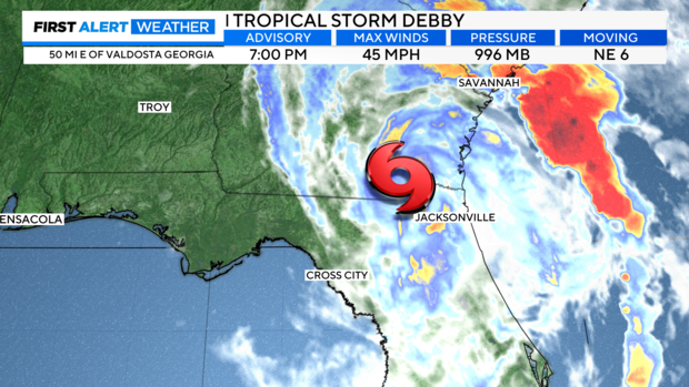
While North Texas deals with the heat and generally dry conditions through the work week, the southeast United States is already feeling the impacts of Debby. As of 7 p.m. Monday, Debby remains a tropical storm and northeast movement hasn't slowed down or sped up.
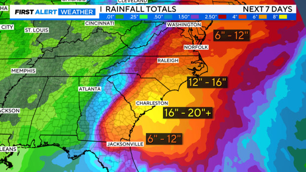
With tropical systems, headlines are always about coastal flooding, storm surge, and winds. Debby has and continues to bring all those threats, but another one we will be watching is the catastrophic rainfall that will accumulate for inland areas of Georgia and the Carolinas. We're talking about areas 50+ miles from the coast receiving over a foot of rain. It will be devastating.
Locally, rain chances are very limited.
Heading into the weekend, you'll notice a northerly component to our wind starting Friday and continuing Saturday. A weak cold front will bring a subtle shift in winds, and humidity, and it'll finally knock our temps back down to near 100. Rain chances are 10-20% at best.
