Dangerous heat could trigger a warning in North Texas
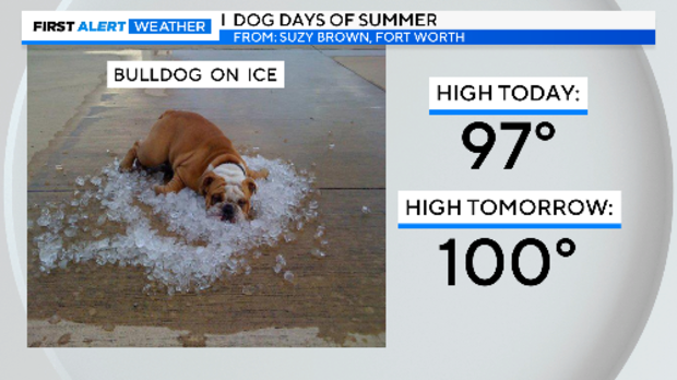
NORTH TEXAS — Are the dog days of summer getting to you? Try a belly flop on a big pile of ice!
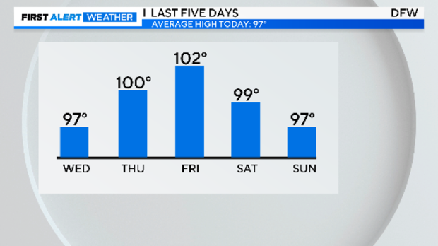
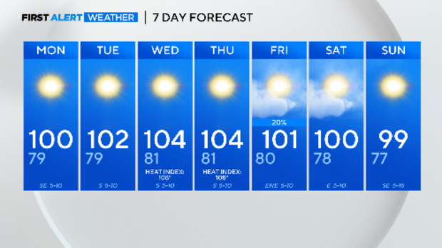
The weekend closes with the second day in a row of a high under 100°F at DFW. This is on the heels of the hottest summer day so far this year on Friday. Sunday was a typical summer August day. The average high for August 4 is also 97°F.
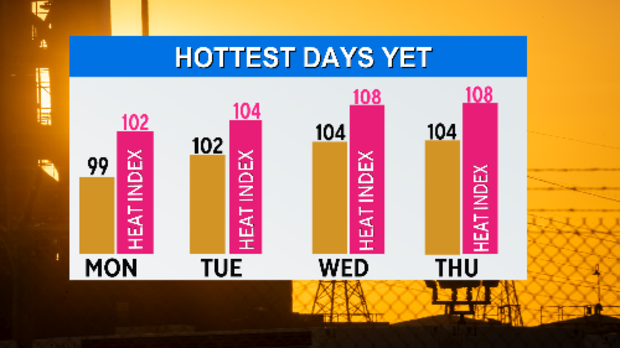
Temperatures and feel-likes are on the rise this work week. We are expecting the hottest days of the year by mid-week. With the humidity, the sun, and modest winds, this is going to be a dangerous heat that might trigger a heat warning.
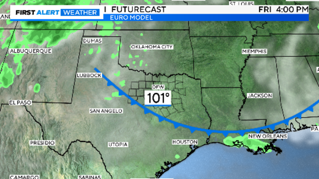
A weak summer cold front comes through on Friday. There may be a 20% chance of rain on Friday as the temperatures get knocked down a notch going into the weekend.
It's August and the hottest time of the year, we expect the heat.
Tropical Storm Debby became a hurricane just before 10 p.m. Sunday night. It will hit Florida sometime mid-day Monday, likely with Category 1 winds.
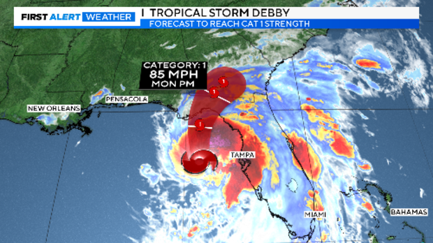
The path of the storm is moving over the warmest water of its journey yet as it moves toward the Big Bend of Florida.
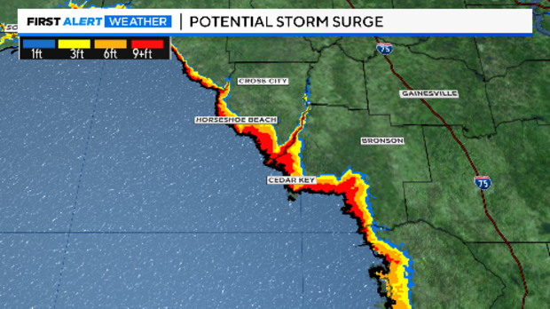
Two huge concerns about Debby: storm surge and historic flooding.
As the storm approaches the shallow water in the Florida panhandle, the storm surge can easily surpass 10ft in this area of the state.
Category Three Idalia last year (August 30, 2023) pushed almost 12ft of water (above sea level) into Horseshoe Beach. Debbie is taking almost the exact same path.
Hurricane Debby is forecast to slow to a crawl as moves close to Tallahassee, extensive tree damage is likely. This happened with Hermine in 2016 with the western wall of the eye over the capital city.
Two things to notice in the Forecast Positions and Max winds. Debbie will draw close to Category 2 strength in gusts as it makes landfall. The other? It spends many, many hours "inland" (hours 36 to 120 minus a brief period just off the Georgia/South Carolina coast).
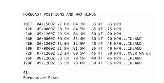
This turns Debbie into a dangerous flood threat. Remember that flooding from Hurricanes kills more people than the wind.
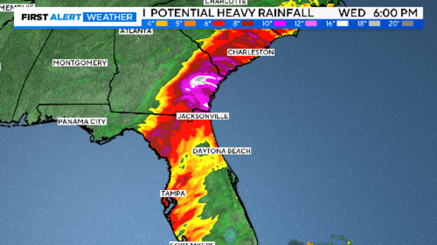
The heaviest rain is currently forecast to fall over Georgia, some areas could surpass 24". Catastrophic flooding would result if Debby follows this path.
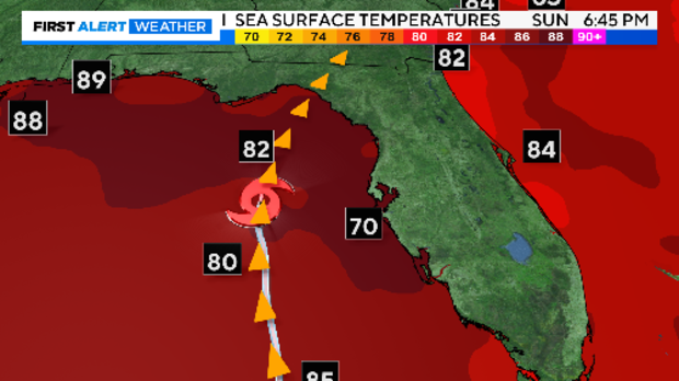
Again, HurricaneDebbie is moving over historically warm Gulf water right now. This is fuel for these storms. Rapid intensification is poorly forecasted by our current models. The First Alert Weather Team will keep you posted. Join Chief Meteorologist Scott Padgett Monday morning to get the latest on the track and strength of this dangerous storm.