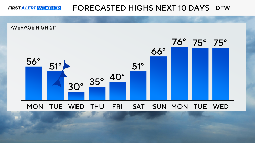
Sunday cold snap in North Texas ahead of dangerous arctic air midweek

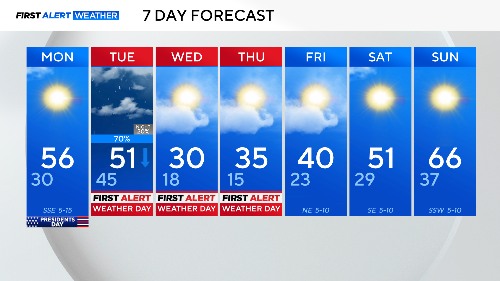
NORTH TEXAS — Saturday was in the 70s, Sunday in the mid-40s and windy. Two seasons in one weekend. Monday looks to be the best day in the week ahead.
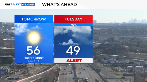
Please note the 70% rain chance for Tuesday. Most of this will be light rain but it will be windy with dropping temperatures by afternoon.
A powerful cold front will drop temperatures in North Texas below freezing by early evening. The last of the rain will be leaving, but brief freezing rain or drizzle could fall that evening, depositing a thin coat of near-invisible ice on bridges and overpasses.
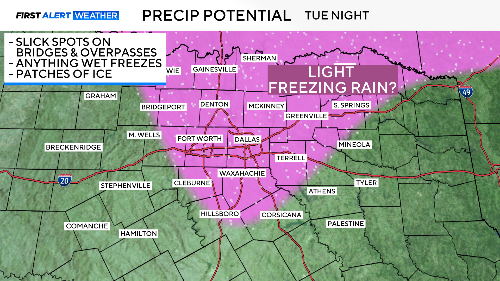
The threat is low but the possible impact is high. The First Alert Weather team will monitor closely Tuesday evening. The warm day (around 50°) and strong winds will help mediate the risk. But there is no escaping the cold.
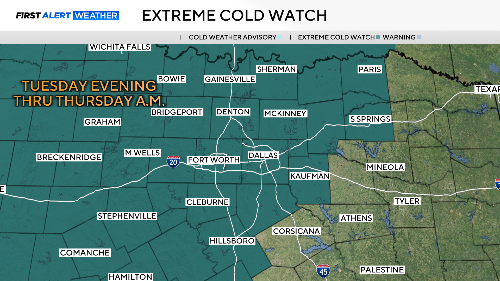
This is the coldest air to hit North Texas in over a year. A cold weather watch starts Tuesday night and continues through Thursday afternoon.
Below you can see the forecasted low and lowest wind chill expected Wed.-Fri.
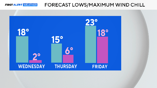
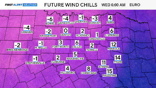
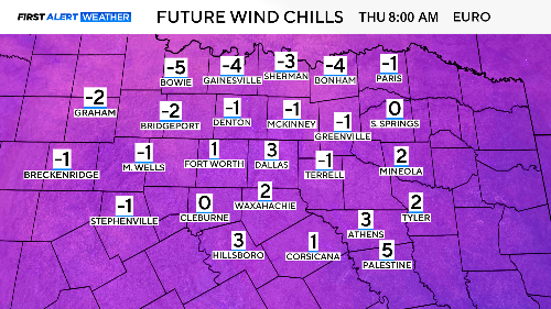
These are dangerous wind chills. Make sure to cover the heads and hands of everyone as you send them out the door both Wednesday and Thursday morning. Some areas will suffer negative wind chills.
We climb out of the cold by next weekend as dry weather and warming winds return by Sunday.
Fear not, by the following week we'll be right back to "spring" weather.