Daily rain and storms expected for North Texas over Labor Day weekend
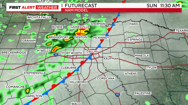
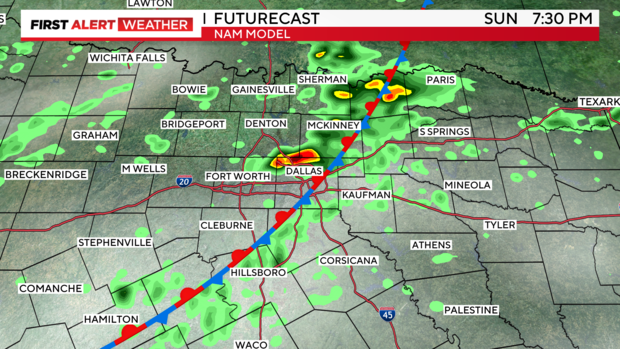
NORTH TEXAS - The NAM 3km model accurately predicts hit-or-miss storms over the next several days, showing the stalled front and its slow progression. Storm chances will likely peak during the diurnal maximum heating of the day, primarily in the afternoon and evening hours. Some storms could be strong, with gusty winds, heavy rain, and lightning. Widespread severe weather is not expected.
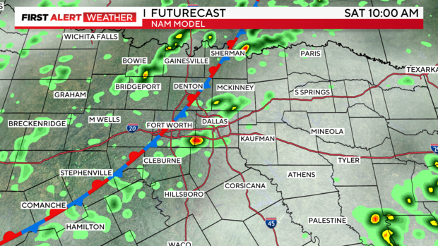
Sunday is trending towards more widespread coverage across the region, according to a few models, so that's something to monitor.
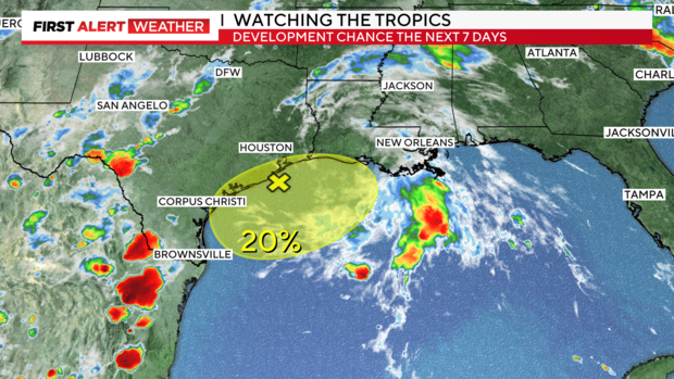
TROPICS: First, the NHC has placed a small chance of formation for the aggravated disturbance off the Texas coast, and although formation is unlikely, some models try to organize this cluster. Also, we'll have to see how this evolves and potentially affects our moisture here.
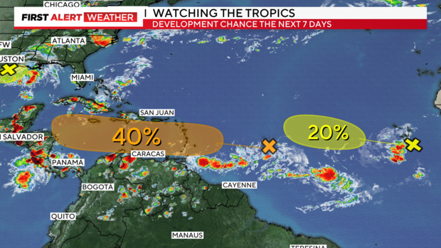
The medium chance of formation shown in orange is something we'll want to watch closely for the Gulf. Many models are trending toward bringing this into the very warm Gulf waters, which are between 85-95 degrees Fahrenheit. (80 degrees is generally the "floor" for sustaining a hurricane). This could become a major storm if it enters the Gulf next week into the following week. Of note: the European ensembles show this already with a small chance of becoming a hurricane, which is very unusual this far out, almost a week and a half. This storm bears watching.
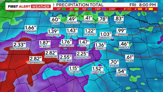
Rainfall projections through next week haven't changed much. Isolated higher amounts are always in play with stalling or trailing storms.
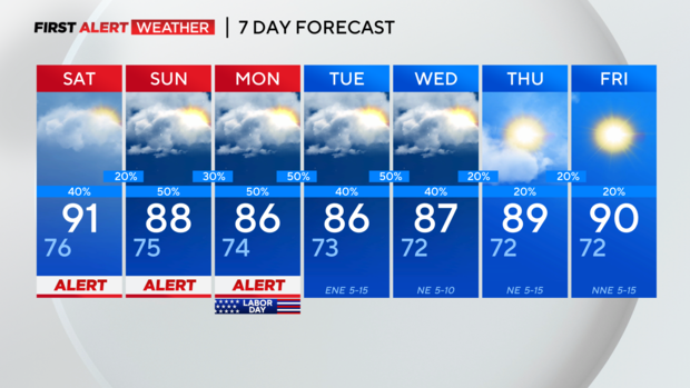
Here's the seven-day forecast:
Have a safe and wonderful Labor Day weekend!