Countdown to spring
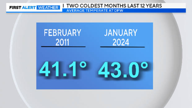
NORTH TEXAS - This past January was very, it was not just your imagination. It is likely your heating bill reflects it.
January 2024 turned out to be the second coldest month recorded at DFW over the last 12 years.
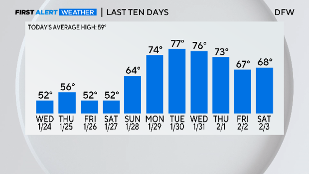
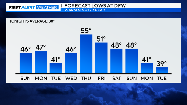
We climbed out that cold month with a nice run of very warm winter days.
This trend is expected to be extended at least into next weekend.
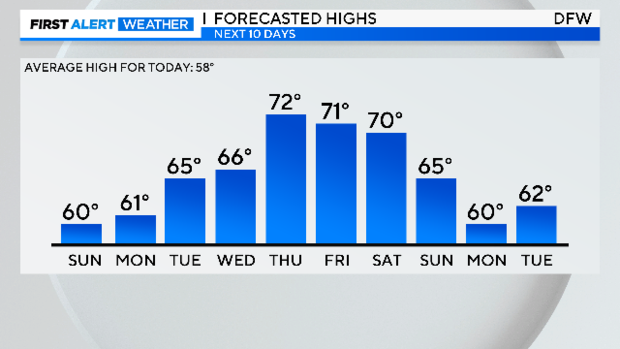
All these warm winter days might be turning your thoughts to an early spring. Certainly, the outlook for next week looks warm.
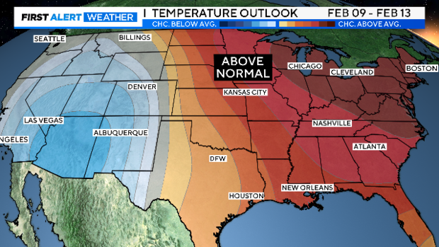
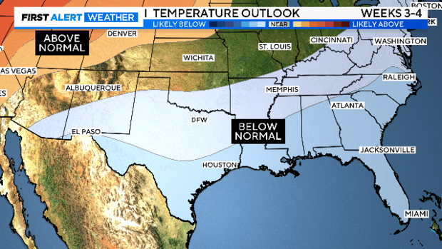
That signal of the possibility of above-normal temperatures washes out in the 8 – 14-day outlook, however.
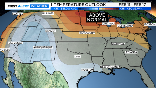
Then it flips over to a chance of below-normal temperatures looking at the last 12 days of February (this is a leap year).
So… what about this coming spring? Let's start by looking at some key dates!
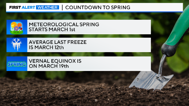
The last freeze at DFW was on Jan. 22. There is a very good chance we'll have another one before we get into Spring.
That said, the earliest last freeze of the season happened back in 2017 when the growing season inside the metroplex actually started on Jan. 9! The second earliest on record is Feb. 5, 2000, so the January date is a real outlier.
By the way, there are no freezes in the forecast for the next 10 days.
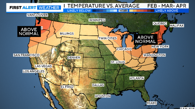
The latest 3-month forecasts came out on Thursday and includes February and the first two months of spring. There is no clear signature on whether the next three months will have below or above-normal temperatures for Texas.
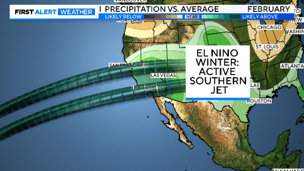
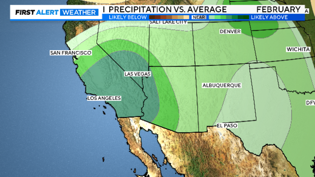
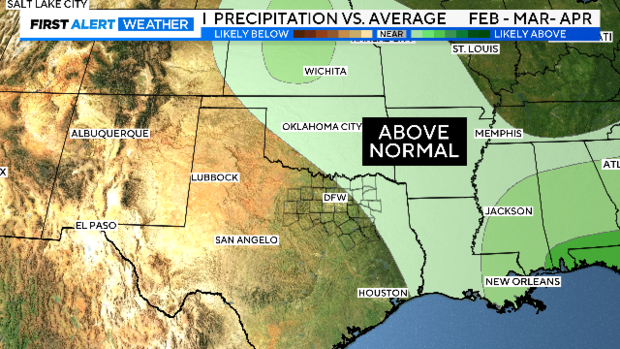
But what about rainfall? We had a wet January this year thanks to it being an El Nino winter. An active southern jet brings massive rainfall to the west coast. Even though we sit 1,500 miles from the beaches of Los Angeles, we are in the general upper airflow of this weather pattern. The February forecast is for a very wet west coast and a chance of above-normal rainfall for us.
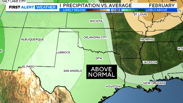
For the next three months, some of North Texas has a slight chance of above-normal rainfall. Just getting around normal would be a big improvement over the last two years.
We traditionally have a rather uneven history of spring rainfall here in North Texas. Just look at the last 10 years. Back in 2015, DFW logged the second-wettest spring on record. Then, just two years later, the sixth driest spring on record (records go back to 1899).
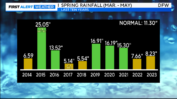
Notice also the last two springs of below-normal rainfall. We not only had a dry spring last year, we also had a dry year. Some of our area lakes in our western half haven't been close to full pool in some time.
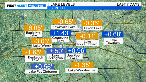
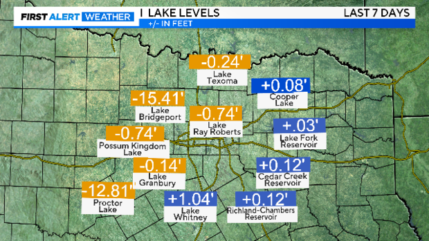
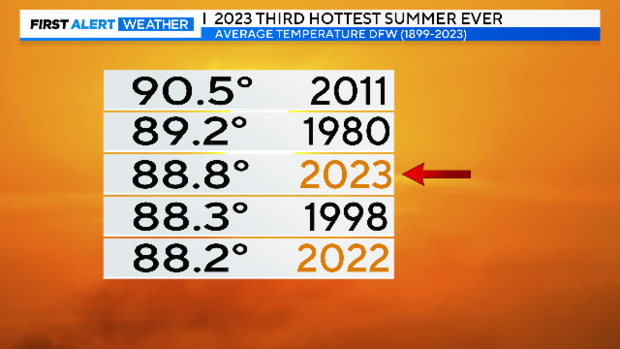
Lake Bridgeport is in fact more than 15 feet below level, Eagle Mountain more than six feet. If indeed this wet trend continues, we could improve our water supply in these areas just as we get into the growing season. Let's hope for that. And of course, something other than a super-hot summer. We've had two of those in a row.
Jeff Ray is the senior First Alert Meteorologist at CBS News Texas and an avid gardener. When not covering the weather, he is reporting for our series "Climate Connection". If you would like Jeff to come talk to your group about how changing weather patterns are changing the way we garden in this area, please email him at jaray@viacomcbs.com.