Cooler weather ahead, rain possible after hot July 4th in North Texas

NORTH TEXAS – A trio of triple-digit highs have kicked off July. In all, there have been five such days so far this summer.

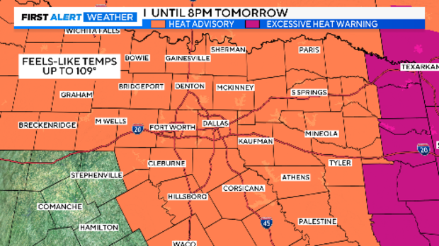
For the 11th day in a row, a heat alert is in place for North Texas. Thursday will have a heat advisory until 8 p.m. Please practice your heat precautions for tomorrow during all the picnics, parades, and fireworks.
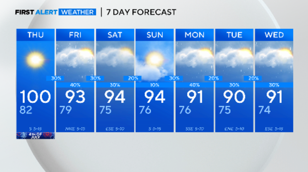
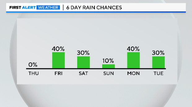
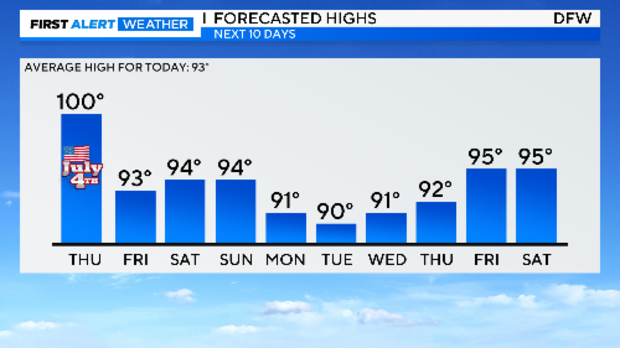
Looking at the forecast for the long holiday, Thursday is the only 100° day. Then rain chances show up.
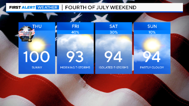
As the heat dome moves to the east and weakens, it opens the door for a cold front to come down into North Texas. One arrives late Thursday night and lingers over North Texas through Saturday. Rain chances will start Thursday night.
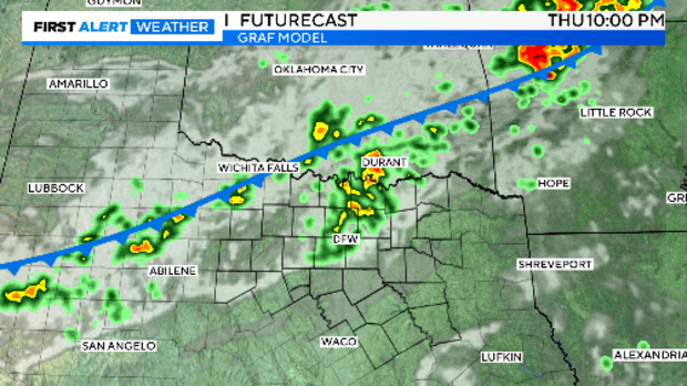
The better chances are on Friday, but rain chances continue through the weekend and beyond. Yes, after no rain at DFW for three weeks, suddenly rain chances will exist every day.
Rain chances next week are very dependent on the path of Hurricane Beryl once it moves into the Gulf of Mexico. It hits the Yucatan on Friday, likely as a category two hurricane, and immediately weakens.
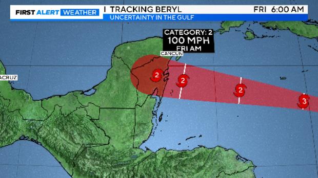
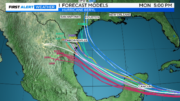
The official forecast has it reforming as Category 1 storm before coming on shore somewhere in northern Mexico or southern Texas late Monday. There is an unusual amount of uncertainty on its path once in the Gulf.
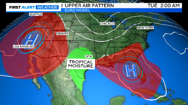
The upper air pattern over the southern half of the United States lends a hand here. With Texas sitting between two high-pressure systems (an area called the "col" or saddle point), there is a clear path for all the tropical moisture from Beryl to reach into North Texas.
There is nothing "random" about the weather. What happens today affects what happens tomorrow. What happens one season or one year will affect what happens the following season or year. We call this "serial correlation".
Hurricanes create a massive water vapor pool through the depths of the atmosphere. With this moisture being drawn into Texas during early July, this changes the entire first half of the July forecast. Rain chances linger all next week. Temperatures are in the low 90s instead of the triple digits. Then we'll go another cycle of slowly getting rid of the soil moisture when we get back to hot and dry weather. This holds the highs down a little each day. Here are the forecasted highs for the next 10 days.
So, relief from your cooling and water bills is on the way. Here is the 7-day forecast.