Cooler temps, less wind on deck for DFW ahead of spring equinox

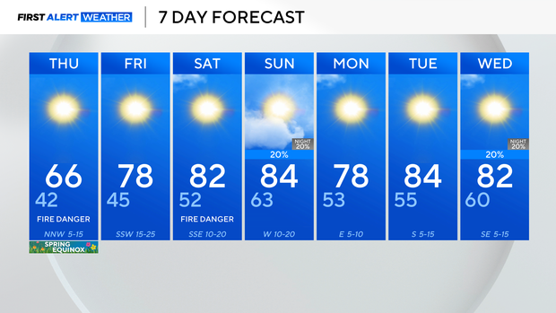
Cooler, closer to seasonable temperatures move in for the spring equinox Thursday. It will also be less windy. But the breeze will pick back up at end the week, and elevated to critical fire danger will linger into the weekend.
A cold front worked through earlier Wednesday, bringing a shift in the wind, and another windy, gusty day in North Texas.
Cooler air sticks around into Thursday, with morning lows in the 30s and 40s.
Some spots to the west will be looking at temperatures within a few degrees of freezing on Thursday morning, so it's not a bad idea to cover sensitive plants overnight.
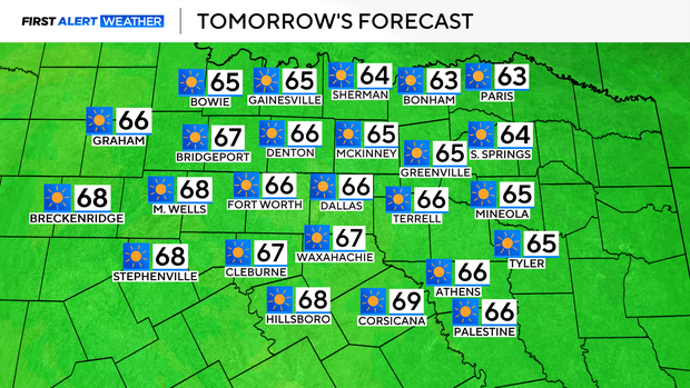
By Thursday afternoon, highs top out in the middle 60s for the Dallas-Fort Worth metroplex, putting the area just a few degrees shy of normal for the Spring Equinox, which officially arrives at 4:01 a.m. CT. It will be less windy too.
The flow shifts more southerly once again on Friday and into the weekend, which means the fire threat continues through that point.
That southerly flow also warms us back up, into the upper 70s Friday, and eventually the 80s by the weekend.
Even with spring officially upon us, no real spring showers are in the forecast.
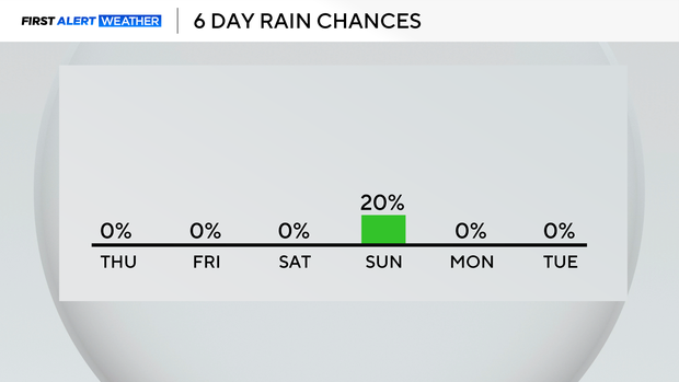
Rain and storm chances are low for Sunday, primarily for areas east of I-35 as a system brushes past.
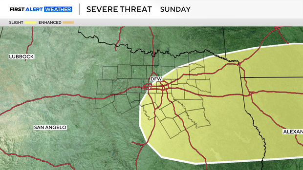
The Storm Prediction Center has parts of North Texas under threat for severe storms on Sunday, but once again, they are looking scattered and primarily focusing on our ESE areas.
DFW's windy stretch looks to die down into next week, and temperatures remain above average.