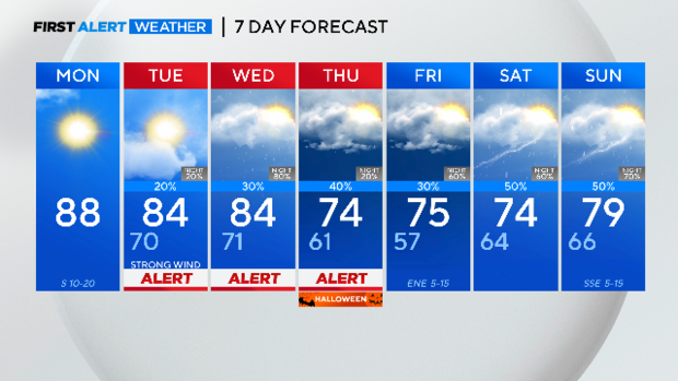
Cooler temperatures return, rain likely in North Texas on Halloween

A weather pattern change headed to North Texas will bring some much-needed rain into the forecast this week. There are a number of weather alerts issued for this week as the cold front approaches.
On Tuesday, expect gusty winds ranging from 35mph to 40mph.
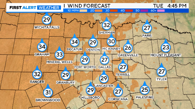
A powerful upper-level trough will move into the western portion of the U.S. on Tuesday. The difference in the high pressure to the southeast and the trough to the west is the tightened pressure gradient leading to the gusty winds Tuesday. This means that now is the time to secure Halloween decorations.
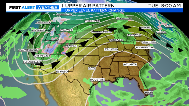
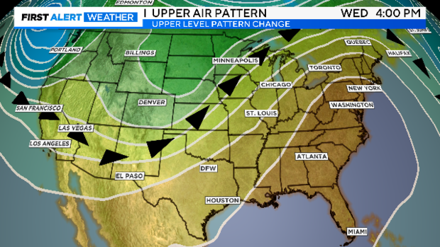
As the trough lifts northeast, a surface front moves into North Texas on Wednesday. There could be strong to severe storms develop ahead and with the frontal passage. The storm prediction center has a slight risk of severe storms in the forecast for Wednesday with the threats being large hail and damaging winds.
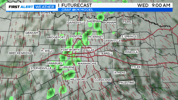
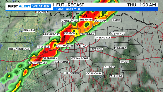
The rain coverage according to the high resolution GRAF model shows most of the day is mostly cloudy with some spotty showers and then a line of storms moving in late Wednesday into Thursday.
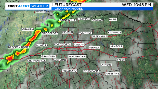
The weather alert for Thursday is mainly for the morning hours with the front moving through and then cooler temperatures on the way. What's new is the timing of the rain. As of Monday morning, trick or treat time should be mostly dry but it will be a cooler day and cooler late afternoon.
Weather alerts could be issued heading into the weekend for more rounds of rain likely. The forecast models aren't in agreement of the rain solution but we could see rounds of rain this weekend which is much needed.