Cool mornings, warmer afternoons ahead for North Texas
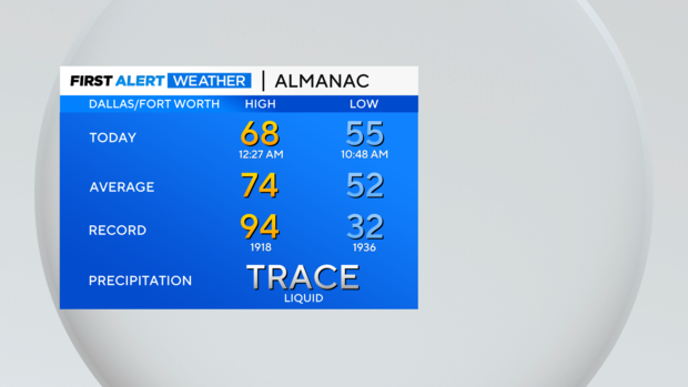
NORTH TEXAS — After severe storms last night, it was a big cooldown Tuesday. We didn't pick up much rain, but temperatures Tuesday afternoon were in the 50s and low 60s. Note the "high" was closer to midnight.
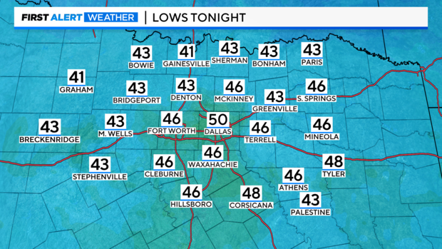
Get ready for a cool morning on Wednesday! Some spots to the north will be in the low 40s!
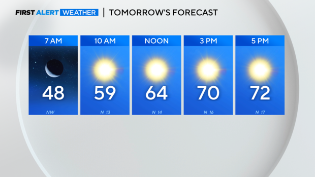
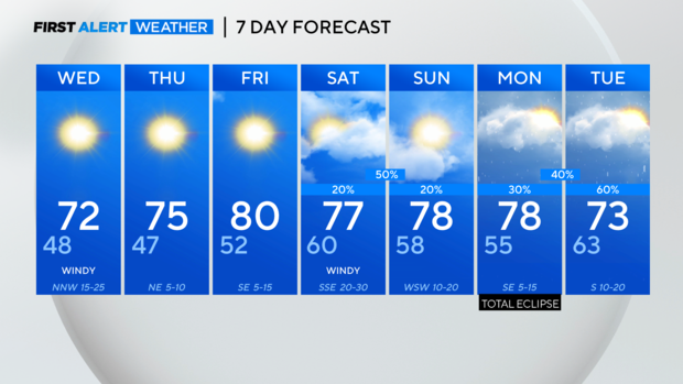
The afternoon will be pleasant though, and it's the start of a warming trend for the second half of the work week.
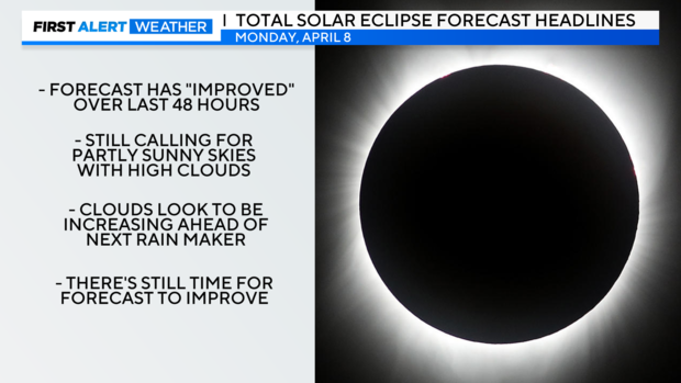
The weekend becomes a bit more unsettled, and of course, everyone wants to know about the eclipse forecast. As of Tuesday night, we're still calling for partly sunny to mostly cloudy skies - but that doesn't tell the whole story.
Two days ago, the forecast was complete cloud cover and rain during totality. So, simply calling for cloudier skies is definitely an improvement from 48 hours ago.
Clouds will be increasing ahead of the system that is slated to arrive late next Monday and continue into Tuesday. If the timing of that system's arrival slowed a bit, we could see slightly better viewing conditions before the clouds really settled in. Given what we're seeing right now, it looks more like high clouds.
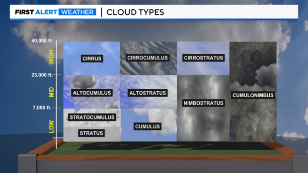
I know saying "high clouds" is pretty vague. If you take a look at the image below, we're leaning towards cirrostratus at the moment. It's not the best viewing conditions, but it's not the worst. And it could continue to improve (fingers crossed).
Cool morning and gorgeous spring afternoons prevail over the next few days.
