Cloudy, warm, breezy Easter; strong storms possible Monday
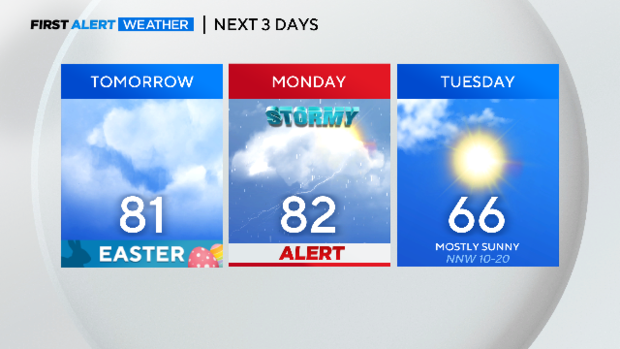
Next couple of days will deliver above-normal highs. Monday looks stormy. Tuesday will be in the 60s and windy.
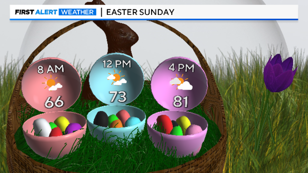
Our Easter Sunday will be much like Saturday's weather: breezy, cloudy, humid, and warm.
The First Alert Weather team is watching Monday. A Weather Alert is in place.
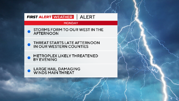
The atmosphere is capped most of the day. The dryline and approaching cold front from the west should provide enough lift to break the cap and get a line of powerful storms going to our west.
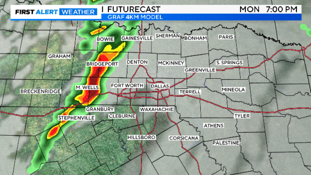
Most of our forecast models show the storm threat in the Metroplex by evening. Large hail and damaging winds are the primary threats. The tornado threat is small but not zero.
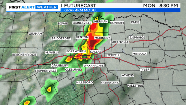
We'll be watching the line come in and break into programming on CBS11 as conditions warrant. For more complete coverage, turn into CBSDFW.COM. Erin Morin and I will be covering the event if it threatens North Texas.
We are nine days away from the one of the greatest celestial events in DFW history, a full total eclipse. We are currently not very optimistic that we'll have optimal viewing conditions. April is our storm season. There is only a 45% chance on any April day. We'd have sunny to partly sunny skies. Right now, we are forecasting only a 25% chance.
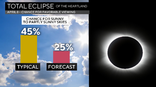
This is a forecast more than a week away. Don't put much stock into it. We will continue to issue daily updates as we get closer.
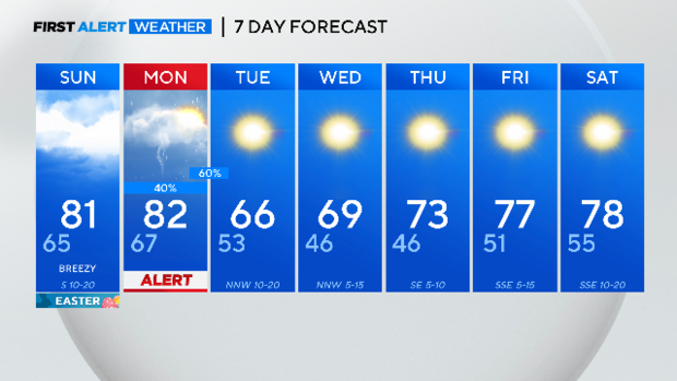
Here is your seven-day forecast. Monday/Monday night appears to deliver the only rain in the week ahead. Enjoy the cooler weather mid-week.