Cloudy, rainy day ahead for North Texas after Beryl makes landfall along coast
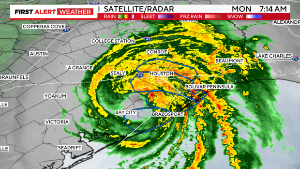
NORTH TEXAS – Rain is on the way for parts of Dallas-Fort Worth after Hurricane Beryl made landfall around 4 a.m. Monday morning near Matagorda as a Category 1 hurricane.
At 7 a.m., Beryl was at Category 1 strength. By 10 a.m., Beryl was downgraded to a tropical storm. Still, 60 mph winds and rains are intense for southeast Texas and the coast and that isn't ending any time soon.
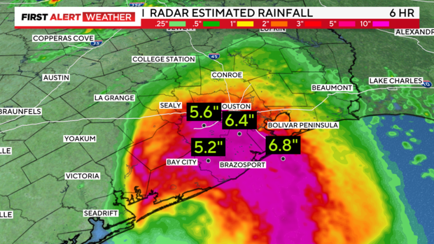
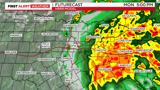
For North Texas, the major concern today will be the flooding threat to the south and east of Dallas-Fort Worth. A flood watch exists for east and southeast counties through Tuesday morning. A widespread 2-4" of rainfall is expected along and to the east of I-45. The farther south and east though, rainfall accumulation totals as high as 8" will be possible.

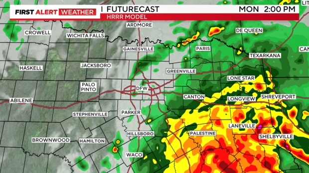
There has already been rain in parts of North Texas before daybreak coming from some of the most outer bands of Beryl. The rain should pick up around midday and continue through the early evening.

Moving into the afternoon hours, that heavy and consistent rain becomes more widespread to the east and southeast.
While the main concern will be flooding rains in North Texas Monday, keep in mind that winds could be gusting around 40 mph in the afternoon and into the evening.
There's also the threat (low but not non-existent) of tropical spin-ups. As Beryl pushes inland and the outer bands move through North Texas, friction between the surface and these outer bands can cause rotation.
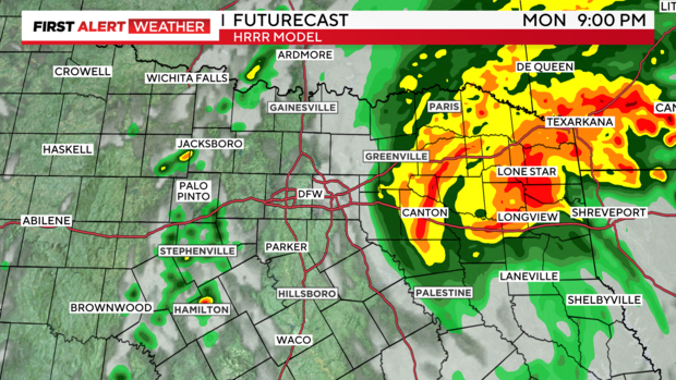
The CBS News Texas Weather Alert continues Monday for the threat of flooding rains. However, Beryl's track has continued to shift east over the last 24 hours, and the timing has sped up. What this means is things clear out faster for North Texas than initially forecast. There will likely be lingering clouds to the east Tuesday morning, but by Tuesday afternoon sunshine should return and highs will jump back to near 90 degrees. It only gets warmer from there.