Cloudy day for North Texas as Hurricane Francine makes landfall along the Gulf

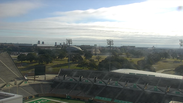
NORTH TEXAS – Wednesday started with partly cloudy to mostly cloudy skies across parts of North Texas as more moisture is in place due to Hurricane Francine in the Gulf of Mexico.
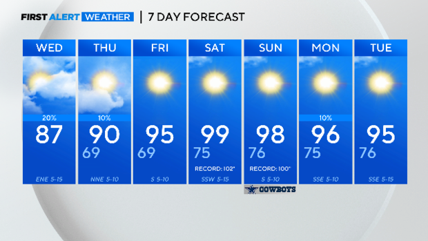
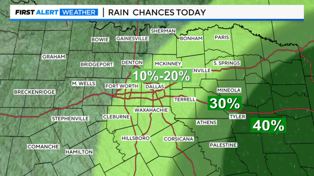
A few showers moved into the metroplex around 9 a.m. Wednesday morning and there is an isolated to scattered shower chance throughout the day ahead. Most of the Dallas-Fort Worth Metroplex has a 10% to 20% chance for storms.
Stronger rain chances are more likely further southeast of the Metroplex.
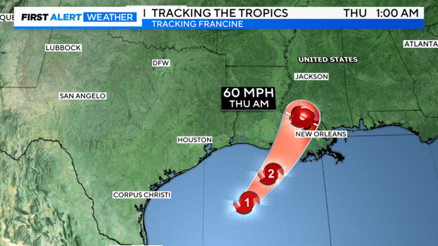
Francine strengthened overnight to a strong Category 1 hurricane as it continued moving northeast Wednesday morning and has picked up a little bit of forward speed. Francine is forecast to strengthen through the day to a Category 2 hurricane before making landfall later in the afternoon to early evening on the Louisiana coastline.
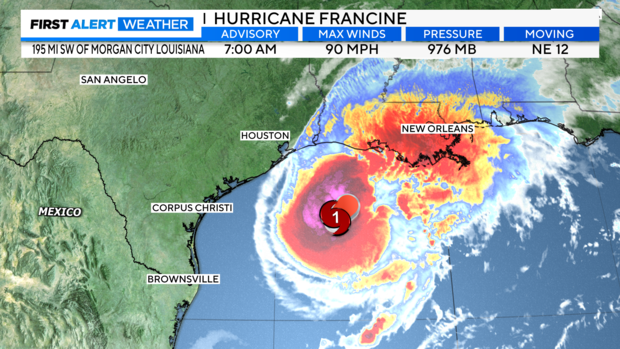
According to the National Weather Service, life-threatening storm surges and hurricane-force winds are expected in Louisiana Wednesday afternoon.
There won't be large impacts in North Texas from Francine, but some will see some isolated to scattered showers, more cloud cover and a humid day.
High pressure will build in at the end of the week and begins another stretch of hot days. In fact, weekend high temperatures will be a few degrees shy of tying record highs in the 100s.