Cloudy day ahead of strong storms
NORTH TEXAS - Heads up! Strong storms are possible in parts of North Texas tomorrow.
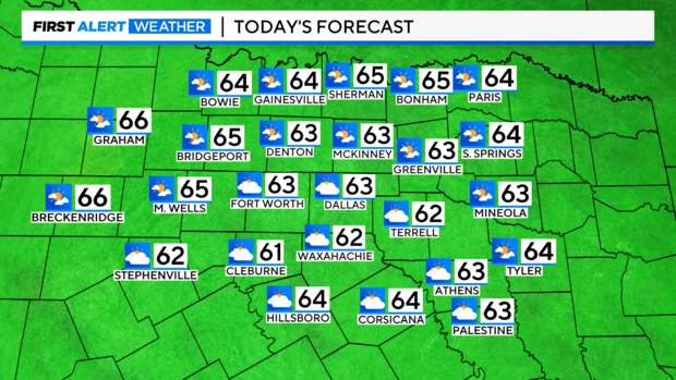
But first, as we move through your Wednesday, expect increasing clouds. We'll see some sunshine, but by afternoon, more clouds than sun will be the rule. High temperatures will be in the low 60s.
Tonight, low temperatures will be in the mid 50s. We'll see cloudy skies and a chance of rain, especially after midnight. However, rain chances will ramp up through Thursday.
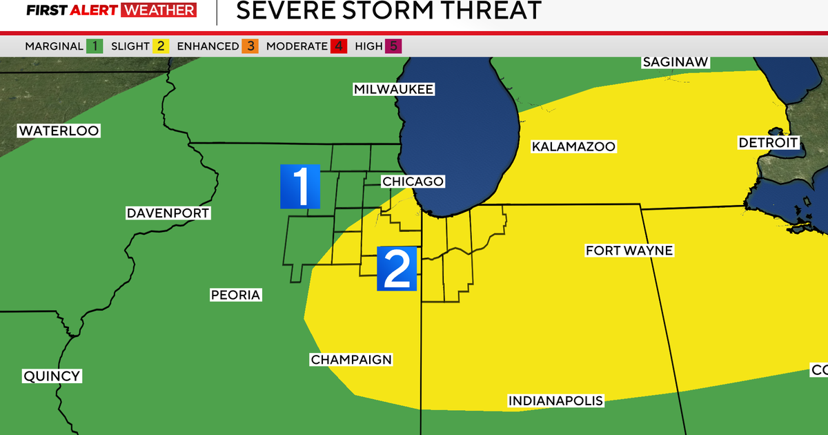
In fact, Thursday is a Weather Alert for the threat of strong storms in parts of North Texas.

A cold front will slide into the area Thursday, giving way to rounds of rain along with a few thunderstorms during the morning and afternoon. Some storms could be strong and possibly severe.
The Storm Prediction Center has posted a Level 1 Risk (Marginal) for strong to severe storms for much of North Texas. However, areas along and east of I-35 and I-35E will have the highest threat for strong storms with gusty winds and even heavy rain.
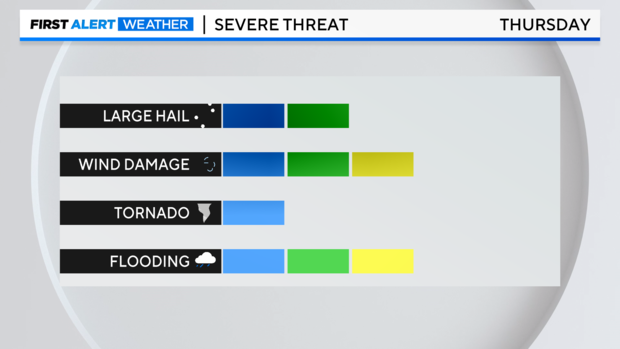
In fact, some areas could see between a half inch to an inch of rain. Watch out for localized flooding. Small hail is also possible.

Rain will likely clear the area late Thursday night as the front passes to our east.


Highs on Thursday will be in the low to mid 60s. But by Friday, with winds coming from the northwest, we'll cool down into the upper 50s.
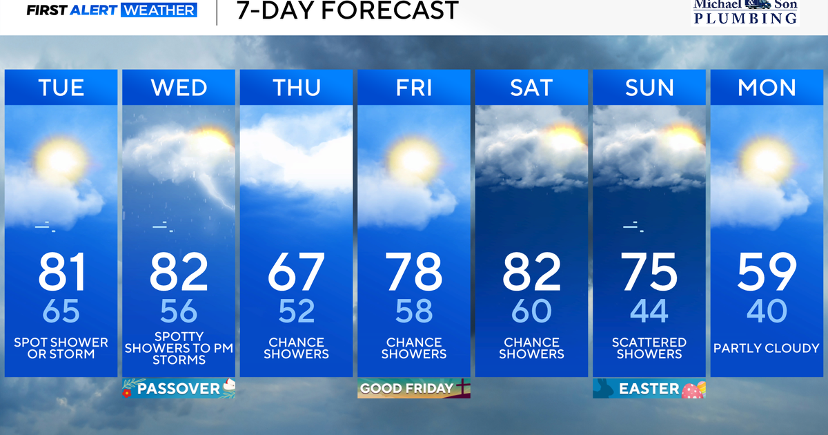
Temperatures will be in 60s this weekend.