Clouds expected for total eclipse Monday
REST OF TONIGHT
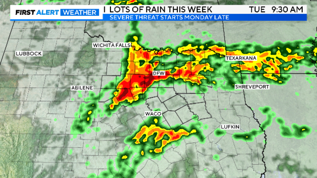
A line of storms has developed along an approaching Pacific cold front. These storms will threaten our northern counties as well as the northern parts of Metroplex tonight. Lighting and gusty winds possible with these storms.
NEXT THREE DAYS
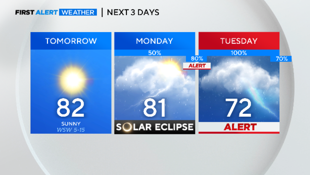
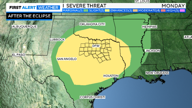
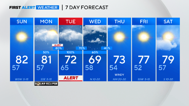
Less than 48 hours from the biggest astronomical event in DFW modern history and the weather is NOT cooperating. We have clouds and rain chances in the forecast Monday, storms (possible severe) by Monday night.
Sunday will have excellent weather. Sunny skies, extremely low humidity, a pleasant breeze; all the makings for a great Spring day. We missed optimum viewing conditions by ONE day.
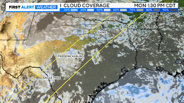
We are expecting low clouds to already be in place by Monday morning. They'll break apart some by afternoon with high clouds overhead. A few breaks in the clouds are possible during peak totality (around 1:40 p.m.-1:42 p.m. across North Texas).
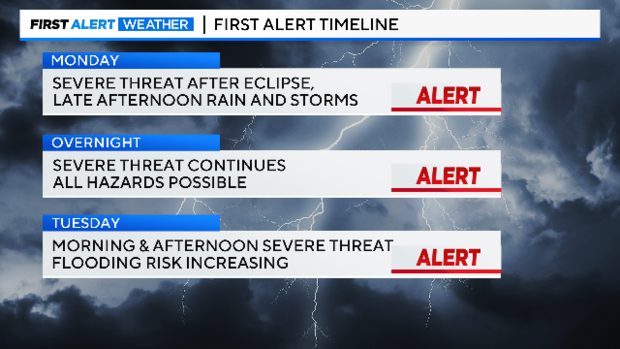
WEATHER ALERTS on Monday late afternoon and continue Tuesday. The storm/rain threat doesn't end until Wednesday night.
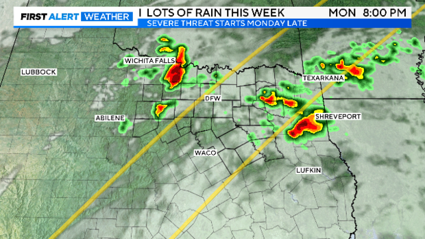
Rain and storms will be quickly closing in as the afternoon progresses. Storms are expected by early evening.
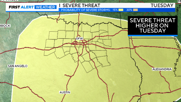
Tuesday looks to be the worst of it. Several rounds of severe weather are possible with the first one arriving in the morning hours.
All modes of severe weather are possible by Monday night: Large hail, damaging winds and isolated tornadoes. The threat is higher on Tuesday, but both days are almost dead center of a SLIGHT risk per the Storm Prediction Center.
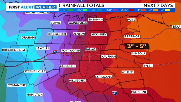
The FIRST ALERT WEATHER TEAM is expecting several days of a severe weather threat. By Tuesday mid-day on, this could also become a FLOODING THREAT. Models continue to forecast very heavy rainfall over the three-day period.
With the historical eclipse and several days of severe ahead, please stay tuned into CBS News Texas for the latest forecast updates. The First Alert Weather Team is expecting some very long workdays all the way to Thursday. The week should end with nice weather.
