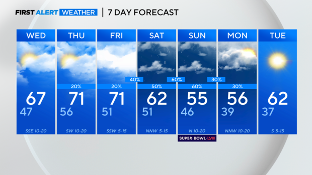
Breezier, cloudier, warmer the next few days
NORTH TEXAS - Clouds have been on the increase Tuesday, as expected, but highs have still gotten into the mid and upper 60s!
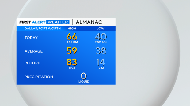
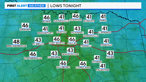
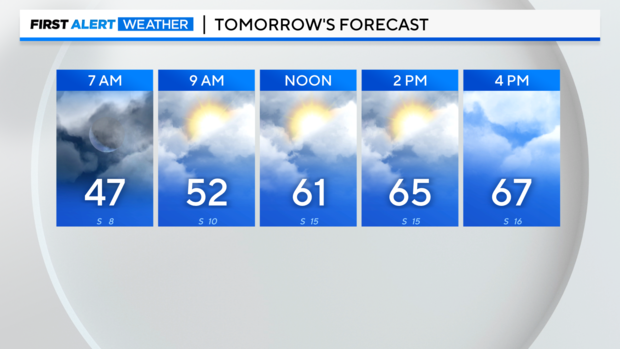
After starting in the 30s for most of Tuesday morning, we get back into the 40s by Wednesday morning with mostly cloudy skies and breezy south winds.
Partly sunny skies and south/southeast winds at 10-20 mph will get us into the mid and upper 60s again by Wednesday afternoon.
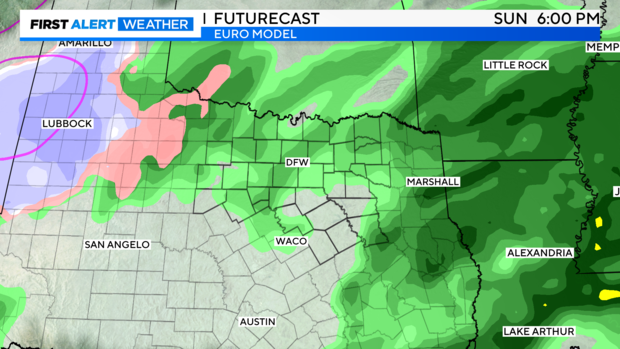
More clouds, breezy southerly winds, and a warming trend are the big story through the rest of the work week. By this weekend though, the story turns to rain returning to North Texas.
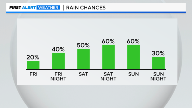
Admittedly, the models keep going back and forth on when the most widespread rain will move in this weekend. It's dependent on a cold front – that cold front potentially stalling across the area for a while, when it finally pushes through, and when this overall system finally lifts out of the region.
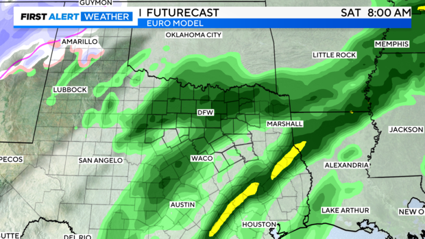
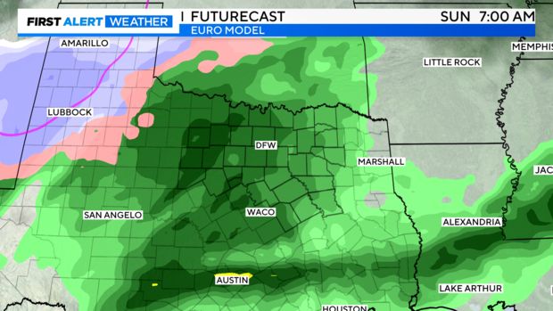
As of Tuesday afternoon, it does look like the system may linger into Monday, leaving us with cloudier skies on Monday and the chance for rain to linger. By Tuesday, we've got sunshine back and temperatures warming back into the low 60s.