Big changes in store for North Texas: cold fronts, storms, possible heavy rain
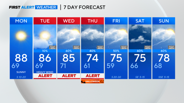
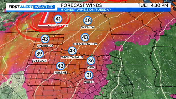
NORTH TEXAS — Sunday was pleasant and Monday will be warm before humidity and gusty winds arrive on Tuesday. A few streamer showers are also possible on Tuesday. Heavier rain chances arrive Wednesday.
This upcoming week will be quite busy. Unfortunately, the following week also looks like it might be busy as well, just in time for the election.
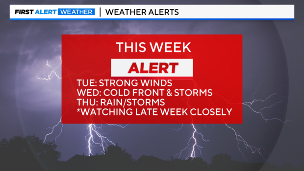
First Alerts are in place for Tuesday, Wednesday, and Thursday of this week. Additional might be warranted later this week or next weekend, depending on trends.
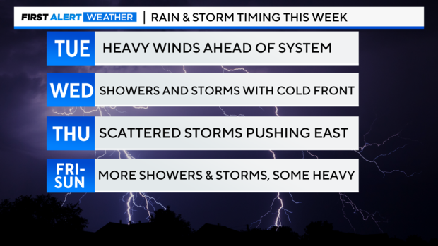
Moisture and humidity return Tuesday with high wind gusts.
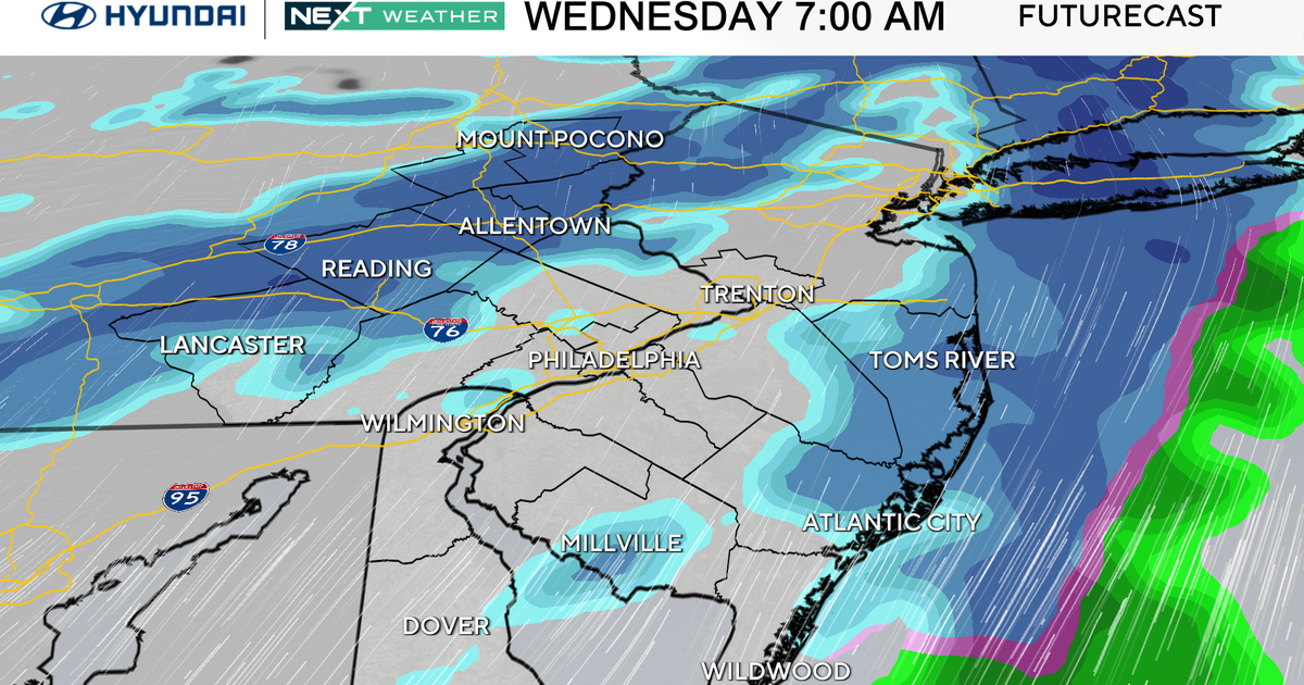
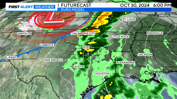
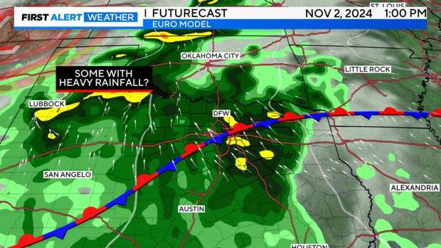
The Euro and American models are refining the time of arrival of our first frontal passage down to Wednesday afternoon-evening. Some storms could be marginally strong and have heavy rainfall. The overall severe threat remains low, but a few good updrafts capable of damaging winds or very brief hail can't be ruled out.
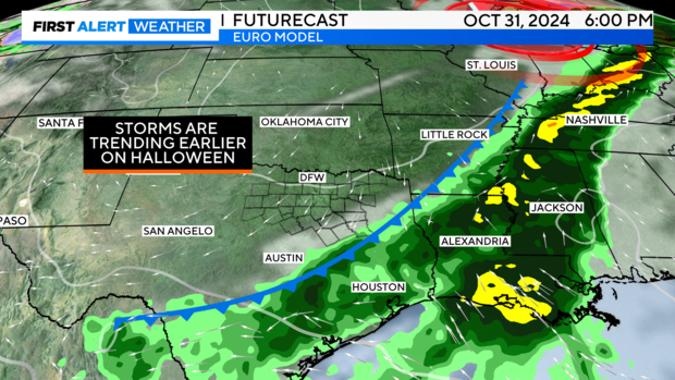
The Euro continues to push storms and the front out to our east prior to the evening of Halloween.
There is still uncertainty for next weekend, but heavy rainfall is still possible if the frontal boundary stalls and more impulses push through the region.
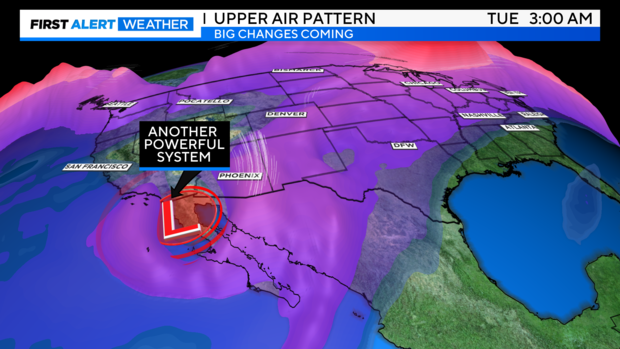
The week after next, another very large trough looks to dig over Mexico and Baja California before ejecting over the central and southern plains. If this is verified, it could bring more unsettled weather and perhaps significant weather for Texas. We'll want to watch the trend on this.
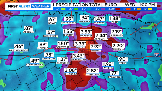
Model projected rainfall.
7-day forecast: