Beryl poised to reintensify as hurricane, strength remains uncertain
NORTH TEXAS – Some short-term good news Saturday regarding Beryl.
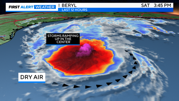
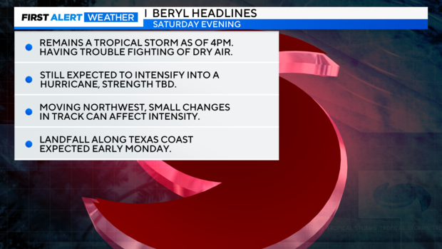
First, Beryl is struggling to fight off the dry air infiltration from the southern and eastern sides, and the longer this continues, the chances of RI (Rapid Intensification) decrease. However, the sea surface temperatures in the western Gulf, directly near Beryl have been extremely warm (88F+) and are still conducive for rapid intensification. These waters are almost as warm as the waters that developed Harvey into a Major Hurricane in August of 2017 in about 48 hours.
In the center, thunderstorms are going strong and trying to align around a common center. Once an "eye" re-forms, intensification will be well underway, and I expect that to happen in the next 6-12 hours. A Hurricane Warning has also just been issued for parts of the Texas coast from Baffin Bay to Sargent. (This is basically from north of Corpus to just south of Galveston).
Looking ahead: We'll see if Beryl overcomes the dry air this evening and begins to intensify. If this occurs, intensities could go above what the current NHC forecast has for landfall-a Cat.1.
If rapid intensification initiates, then many variables can change, including the speed of the overall storm. Right now, landfall should still be around 4-8 a.m. Monday near Matagorda Bay. However, even that can change once a new eye forms and intensification begins. Hurricanes also "wobble" which can affect the track.
Hurricane hunters are on their way again into the storm, and we'll know more soon.
A lot can still change in the next 24-48 hours. Next National Hurricane Center update is coming this evening.
