A weakened Beryl is on the move after making landfall on the Texas coast
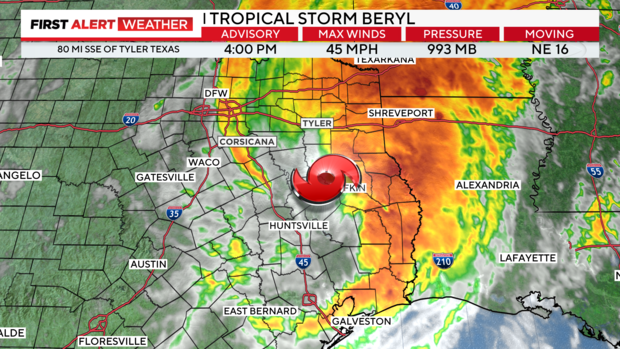
NORTH TEXAS — Tropical Depression Beryl slowly exiting Texas to our east, the remaining storm bands associated with it, and any possible flooding.
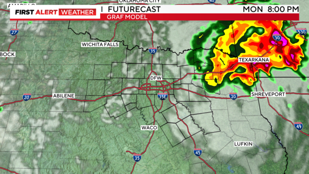
The high-resolution GRAF shows most of Beryl and associated western periphery activity exiting North Texas Monday evening.
"The state's efforts have switched from preparedness to response, and in some areas are quickly moving into recovery," Acting Gov. Dan Patrick said Monday. "Texas has assets deployed throughout the Coastal Bend, the Houston area, and Deep East Texas, and they will work diligently to assist their fellow Texans."
Patrick said there were three storm-related deaths in Harris County, two by fallen trees and one by drowning. There were also three storm-related deaths in Montgomery County and one in Louisiana.
"There are nearly 3 million ratepayers without power and at least 10 transmission lines down. CenterPoint Energy, Entergy, and smaller electric co-ops will work around the clock to assess damages and restore power," said Patrick. "This will be a multi-day restoration event."
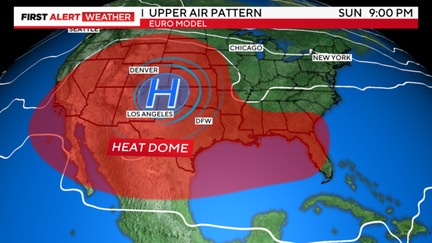
Starting Tuesday and expanding through the weekend and into mid-July, the heat ridge will take over and extreme heat will be right back with us.