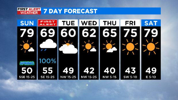
Beautiful Sunday, But Fire Threat Persists And Storms Looms Over Monday
NORTH TEXAS (CBSDFW.COM) - Happy Sunday! And welcome to the Vernal Equinox, gifting us equal part day and night.

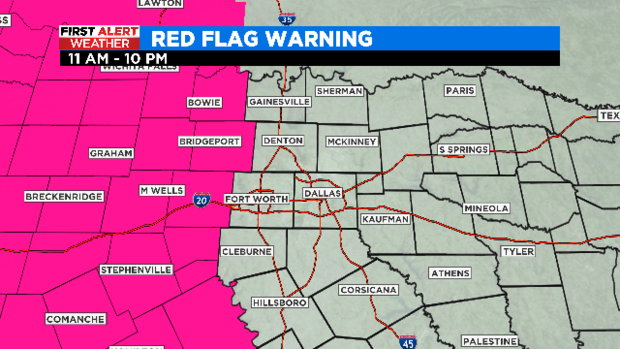
While it will be a beautiful day, the high fire danger continues for all of North Texas and especially west of I-35 where a Red Flag Warning has been issued. Southerly winds will gust to 35 mph and humidity will drop below 20% in the highlighted areas.
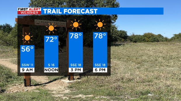
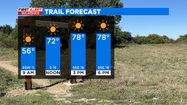
Another gorgeous day to get outside! Lots of sunshine and temperatures climbing to near 80!
We have issued a First Alert Weather Day for Monday due to the threat of severe storms in the afternoon and evening hours.
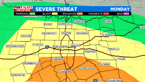
The Enhanced risk (orange area) has shifted a little further south of I-20 and expanded west of I-35.
Similarly the Slight risk (yellow area) has been expanded further north. The metroplex falls under the slight risk.
Large hail, damaging winds, and tornadoes are all possible.
The system is also bringing widespread beneficial rain to North Texas.
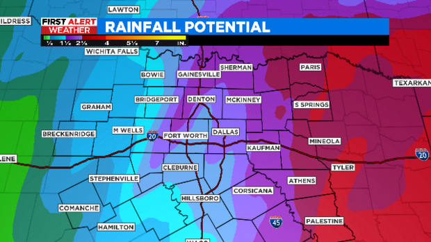
Highest amounts east in the purple/reds with 2-4".
Widespread 1-3" rainfall totals in the metroplex.
Up to 1.5" in western areas.
The storms clear out to the east early Tuesday morning, but some wrap around cloud cover and maybe a few sprinkles are possible through midday Tuesday. From there the week is looking glorious! A bit below normal temperature wise but sunny and enjoyable nonetheless.
I am headed off to the car show and our CBS booth this afternoon.
I hope you all enjoy the rest of your weekend!


