North Texas work week starts out pleasant before arctic air returns with dangerously low temperatures

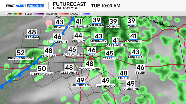
We'll start Tuesday morning off with isolated rain showers, that become a bit more scattered in nature by the afternoon. There will be light rain, scattered on and off throughout the day.
The rain starts tapering Tuesday evening just as temperatures are falling. Temperatures will fall through the 40s Tuesday afternoon, close to freezing by the Tuesday evening commute.
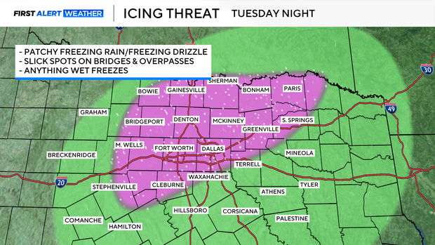
Moisture will be exiting by this time, but any leftover water on roadways will freeze going into Wednesday morning, bringing the threat of patchy ice, especially for bridges and overpasses.
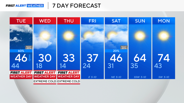
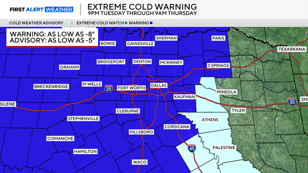
An extreme cold warning takes effect Tuesday at 9 p.m. and lasts through Thursday at 9 a.m. This is for wind chills below zero for much of North Texas on both Wednesday and Thursday mornings.
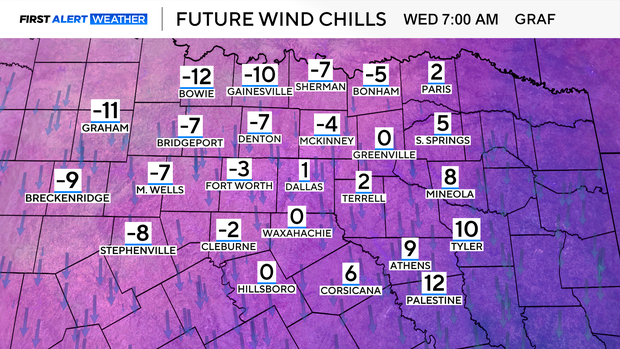
Wednesday will be the coldest morning, with dangerous "feels-like" temps as much as 10-15° below zero for some of our northern counties.
We'll be looking at high temps in the lower 30s during the afternoons for both Wednesday and Thursday, but feeling about 10° colder than that.
Things start improving into the weekend, with highs in the upper 30s Friday, middle 40s Saturday, to the middle 60s by Sunday. The 60s will put us back close to average for this time of the year.