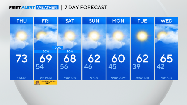
Another warm, spring day ahead of a rainy weekend
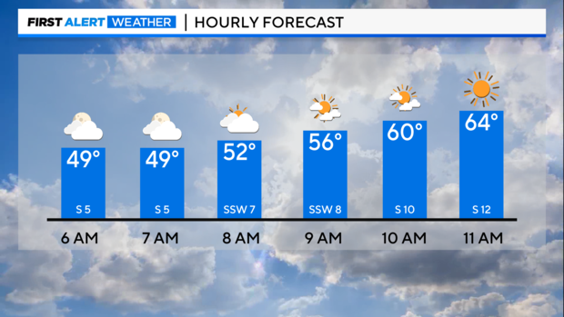
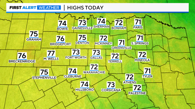
NORTH TEXAS - We are waking up to some clouds and temperatures near 50 degrees as a disturbance moves through the area. You may see some "virga" during the morning hours, which is when it looks like rain is falling from the clouds, but it evaporates before reaching the ground. The clouds clear out for afternoon sunshine, so keep the sunglasses handy! It's another mild day with highs in the lower 70s and southerly winds picking up this afternoon.
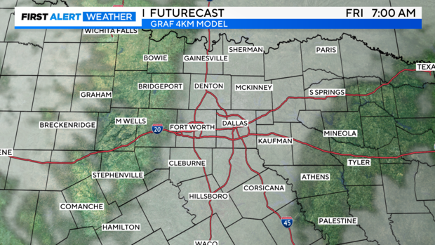
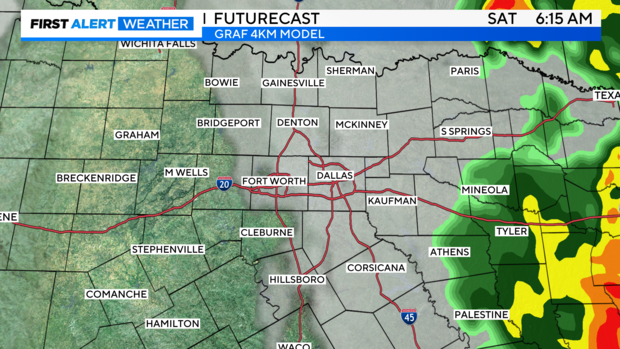
Fog will likely develop overnight and stick around for the Friday morning drive. Temperatures tomorrow remain mild, starting off in the mid 50s and reaching into the upper 60s by the afternoon.
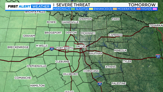
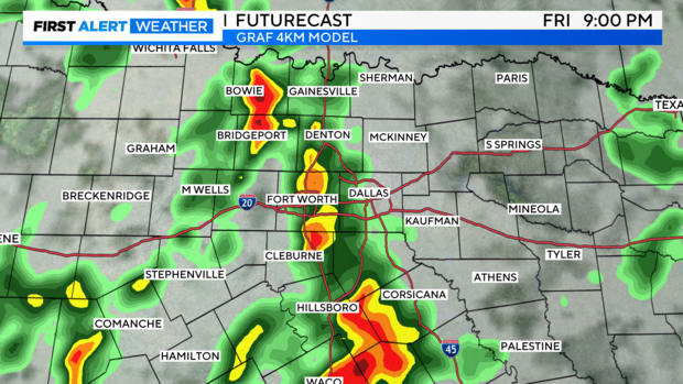
The First Alert Weather Team is tracking the potential for some strong storms Friday evening into early Saturday morning as our next system moves through the area. There is a level 1, marginal risk for areas along and west of I-35. Widespread severe weather is not expected, but a few strong thunderstorms capable of hail and gusty winds are possible.
A cloudy Friday is on the way with scattered showers during the daytime hours, but it won't be a washout. After sunset rain and storm coverage increases from west to east.

Most of us start the weekend dry, with the showers in east Texas by sunrise Saturday morning. A mix of sun and clouds returns for the afternoon along with mild temperatures in the upper 60s.
A cold front returns cooler air to wrap the up weekend, with highs in the lower 60s for Sunday. Temperatures remain closer to seasonal as we start the work week.