Another hot, dry day in North Texas ahead of some cooler temps and light showers
NORTH TEXAS (CBSNewsTexas.com) - Sunday is starting off with a bit of clouds due to a complex of storms to the west. A few showers could hold together in our western areas but they won't make it to the Metroplex.
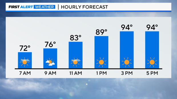
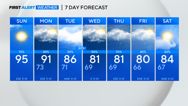
Clouds will break up in the afternoon, as temperatures climb into the mid 90s once again.
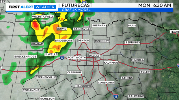
Our first of several disturbances arrives overnight and will bringing rain to North Texas in time for the Monday morning drive. The highest rain chances are west of I-35. Monday afternoon will be drier with highs a little cooler, around 90.
There will continue to be several waves move into the area on northwesterly flow, keeping daily rain chances into next weekend. They won't be all day washouts but you will want to have the umbrella handy.
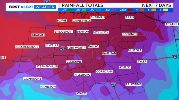
The active pattern next week brings welcome rain that won't end the drought but will certainly help. Widespread 1" - 3" rainfall totals are likely by Friday. Localized flooding is possible as we get into Thursday.
We're still keeping a close eye on Hurricane Lee in the Atlantic. The storm is expected to strengthen this week as it moves northwest bringing dangerous surf and rip currents to the East Coast.
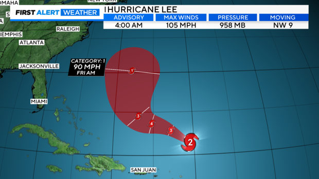
Lee may weaken again late next week as it picks up speed and turns toward the north. We will still be talking about Lee heading into next weekend for possible impacts in the Northeast or New England.
As for your 7-day forecast, cooler temperatures and much needed rainfall are on the way.
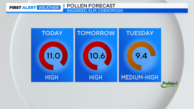
The rain will also help with the pollen count, which is still high.