After the first record-high of summer no heat alerts or warnings Monday
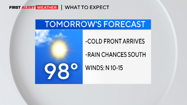
NORTH TEXAS (CBSNewsTexas.com) - A cold front swings through North Texas Monday morning!
Winds will shift to the west then to the NW and get a little breezy, ending the current streak of 100° days.
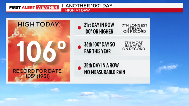
Sunday set a new record daytime high for summer, besting a 72-year record by one degree.
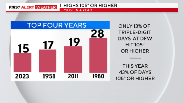
Another 100° day of course, now three weeks' worth of those. The intensity of the heat is worthy of remark. This year is now on the list as the fourth most number of days with a high of 105° or higher. This is an unusually high number. Summer heat with an attitude.
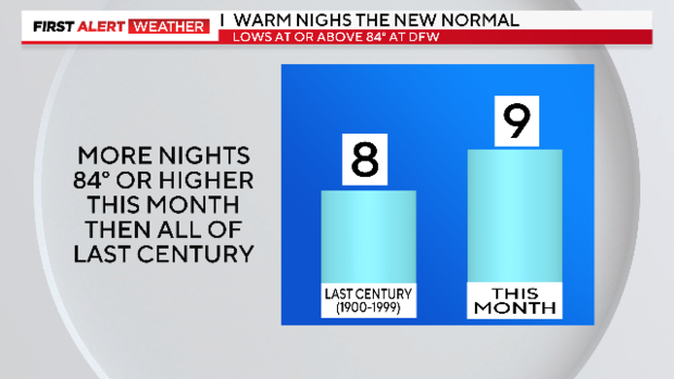
We tied for a record-warm low Sunday morning as well. DFW now has more nights 84° or warmer this month than it logged over the previous century.
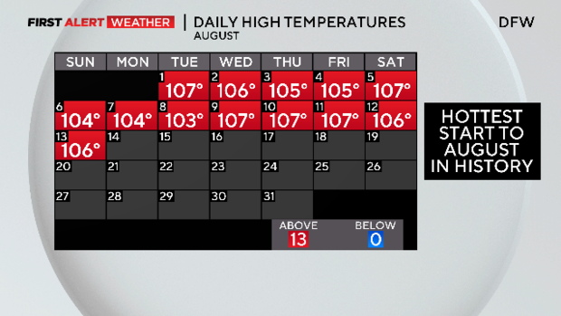
Hey, something to tell your kids: You just suffered through the hottest start to August ever recorded. There were Excessive Heat Warnings every day of August so far.
There is good news: A cold front arrives Monday morning and, for a short while at least, we can leave this kind of heat behind us.
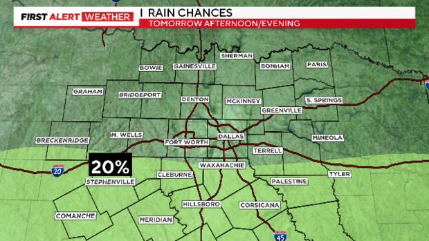
The rain chances are small and south of the Metroplex.
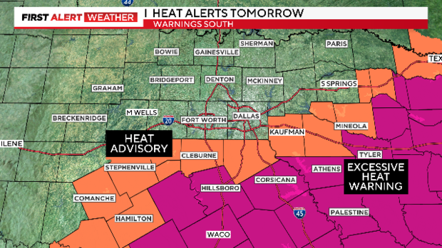
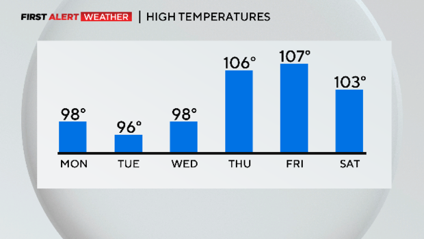
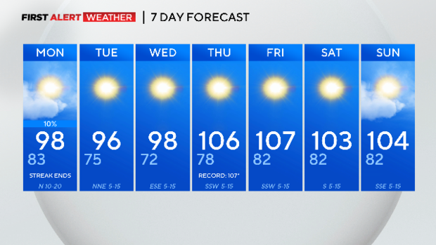
At least this ends a couple of streaks for the DFW area. No 100° days again until Thursday; no Excessive Heat Warning for the Metroplex for the first time this month; and no Red Flag Warning.
The heat doesn't go far. The cold front is slow to reach our southern counties. So there is a Heat Advisory for Johnson and Ellis counties and an Excessive Heat Warning for our southern tier.
Tuesday is downright nice. Very low humidity and highs "only" around normal for this time of year.
As soon as the winds turn to the south again on Thursday, the heat returns with vengeance. With the dewpoints lower, it'll be easy to get to near-record highs on Thursday.
We are currently having the fourth driest summer on record. Without some rain, the fire risk is going to remain high. There is only a small chance of rain south for Monday afternoon and evening. After that, we are back to bone-dry conditions.
Don't count on the dewpoints to stay low very long. The Gulf of Mexico often pumps in the humidity during the summer when the winds get strong enough, and sustained long enough, to bring in those seashore-level dewpoints.
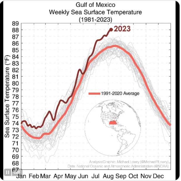
The coastline is 270 miles from downtown Dallas, a little more than the distance of the International Space Station above. Right now the Gulf surface temperature is shattering the record for warmest ever.
This means more humid days and nights, a higher Heat Index in the afternoon and warmer nights.
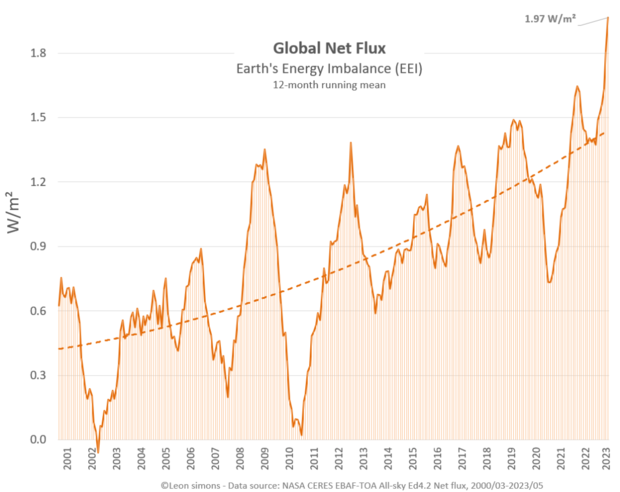
If you are wondering why all these global records are being broken this summer, keep this in mind. The globe has continued to add greenhouse gasses and population over the last two decades. We've doubled the amount of heat the atmosphere is holding in just the last 20 years.
Here is your seven day:

