A late week cold front and more rain opportunities for North Texas
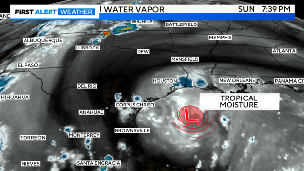
NORTH TEXAS — Better news is on the horizon. On water vapor imagery Sunday evening, you can easily see the tropical trough nearing the Texas Gulf Coast.
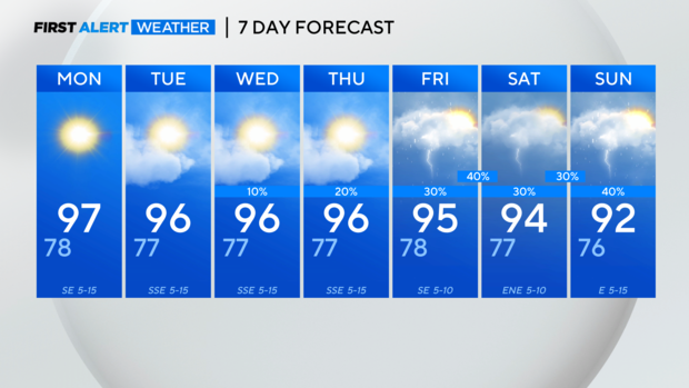
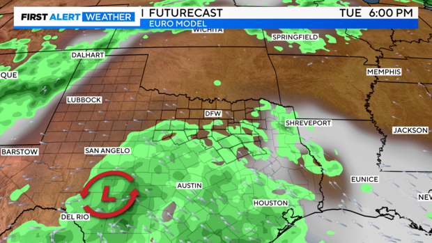
Although it's taken a little while to get here, it'll bring more rain chances, cloud cover, and some cooler temps to the state. So, what's in it for us? Hit-and-miss daily rain chances in the middle of the week, mainly south of I-20.
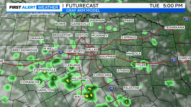
Already, some of our higher-resolution models are producing some activity in the DMA Tuesday afternoon. We'll continue to monitor these trends.
As the upper trough emerges over South Texas early this week, the best chances of rain will undoubtedly be in central and south Texas, however on some afternoons, the activity could approach North Texas.
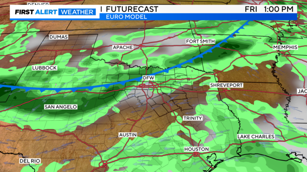
Finally, late week, the cold front approaches North Texas. There's still some inconsistency in the timing, as the major models deviate early the following week as well. The European model tries to push through a reinforcing front the following Monday. But for now, it appears that we're still on track to see a front on Friday with shower/storm opportunities.
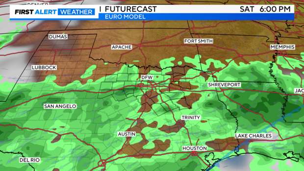
Rain chances continue into the weekend, after the frontal passage. These could be more hit/miss than during the frontal event.
7-Day: Hit -and-miss, diurnal chances Wed. and Thurs., followed by better chances Friday into the weekend.