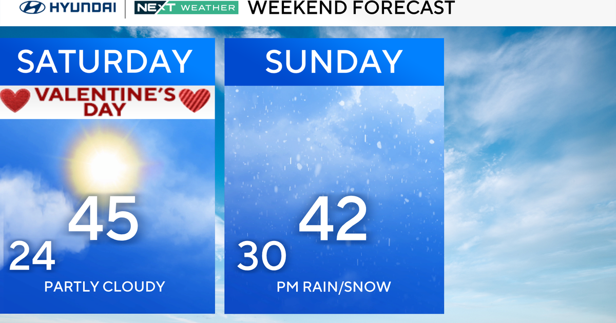
Cold Days Ahead, But Warmup Before New Year
FORT WORTH (CBSDFW.COM) - Yesterday's total rain by midnight at DFW: .99", making it the second wettest Christmas Eve day on record. The clouds just would not leave today; highs stayed in the 30's most of the day and didn't hit 41° until 3pm. Coldest high ever on Christmas was a mere 18°.
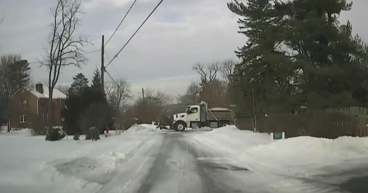
By the way, the cold, snowy winter of the deep south keeps breaking records. They had an accumulating snow on Christmas Day in Birmingham - that is the first time that has occured in their 100 year plus of record keeping. Atlanta is going to get some snow tonight- it'll be the third time since 1880's and the start of record keeping there.
SOME COLD NIGHTS/DAYS AHEAD
Skies should finally clear tonight and temperatures should drop down to the low 20's north and west of the Metroplex and in the mid-20's in the DFW suburbs. Sunny on Sunday but this cold air is firmly in place- highs only in the upper 40's. We won't have the wind like we've had the last few days. This makes the third day of highs in the 40's, the longest stretch of cold weather this season. The warmest we've been since midnight Wednesday morning is 52 degrees. Another sunny day on Monday but highs will barely hit 50°.
A DREARY TUESDAY
With the cold air still around gulf moisture is going to start getting drawn up over the top of it. This is going to result in a foggy morning and low clouds all day. After some morning drizzle, rain develops by afternoon and evening. Highs will stay in the 40's with a small chance of some thunderstorms by late in the day and evening. Not as much rain as yesterday but widespread coverage.
BIG WARM UP BEFORE NEW YEAR
The rain leaves Wednesday morning and winds start to pick up from the south. We should have highs on Wednesday in the mid-60's and then in the MID-70's by Thursday. I can't agree with the NWS about Friday, they think another 70° day but I'm betting the rain and clouds keep us in the mid 60's. Windy and temperatures dropping as a strong cold front hits us…you guessed it:
POTENTIAL FOR A STORMY NEW YEARS EVE
This front could create some severe weather for us. Let's get a couple of days closer to it but it appears like the best chance for some severe weather for the whole month will occur in the last hours of it. Very windy as well. We'll be spared the really cold air from this one but highs on Saturday (New Years Day) likely only in the upper 40's and cloudy.